Hi All~
This Eletter with
all the links to fabulous life-sized photos is at:
http://www.ciekurzis.org/Across
the Bank to Chub Cay/Across the Bank to Chub Cay.htm
Across the Bank to Chub Cay
After our stay in the Bimini Islands was
complete, the weather turned just enough to allow us to head off across the
Great Bahamas Bank. We still needed to use the engine for the first section of
our route, but the seas were kind and the depths across the Bank were not as
scary as some would have you think. Although making a “pass” at night (that is an entry to- or exit from- the
Banks) for a novice would be unwise, traversing commonly used routes can easily
be done at a moderate speed in the dark. [More at the end in the “Cruisers
Notes”]
We arrived at the Northwest Channel Light
at daybreak, and entered Chub Cay Harbour at noon. Chub Cay has the closest
full-service marina to the northern Tongue-of-the-Ocean. Along with (and
alongside) Exuma Sound, these two strips of very deep water are unique in the
world and they attract fishermen and divers from everywhere. Leaving the Banks,
the depth drops from 10 feet to a thousand feet in a distance of 1000 yards; we
sailed over mile-deep ocean to arrive at Chub Cay. Very pretty water color!
The Character Of The Land.
Chub Cay is as different as it can be from
Bimini. It is part of the Berry Islands: a smattering of tiny islands and
good-sized rocks across the north-central Bahamas. Many of these are “private”,
and that label means different things to different islands here. Some Bahamian
islands are actually owned by "a guy" who doesn't wanna see anybody
else on 'his' island. Enough said = NOT INVITED.
Some are owned by a particular cruise line,
and two or three days a week they get invaded by 2000 tourists that enjoy all
the beaches, restaurants, pools, and other man-made and natural attractions as
part of their cruise package. Although not invited to dinner, us cruisers are
'allowed' to anchor (out of the way) and visit natural sites on our own (but it
should be done on an 'off' day).
Some seem a little more inviting; to a
degree Chub Cay is one of those. It is not owned by The Man, but The Men, as it
is kind of a co-op. many LARGE houses are going up simultaneously and the
marina is full of 100’ yachts.
Cruisers are allowed to process customs and
immigration there at the marina, but it'll cost $100 to use the dock (the
Government Dock in Bimini is free, as it is most places). We are even allowed
to go to the stores [BOTH of them-poorly stocked], restaurant, fuel at the dock
[$3.44/gallon for diesel] & water [at 42˘/gallon, we passed] and whatever
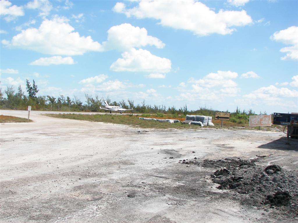
else there, too. One can roam the streets, as Karin made the two-mile trek to the airport often (yes, the
road IS the runway for a mile!). It is not cheap to patronize a 'private'
island that allows outsiders.
The beach in front of those homes is
CLEARLY marked = NOT INVITED. But the rest of the island is sparse and
desolate. The swamp between Chub Cay and Frazer’s Hog Cay has long ago silted
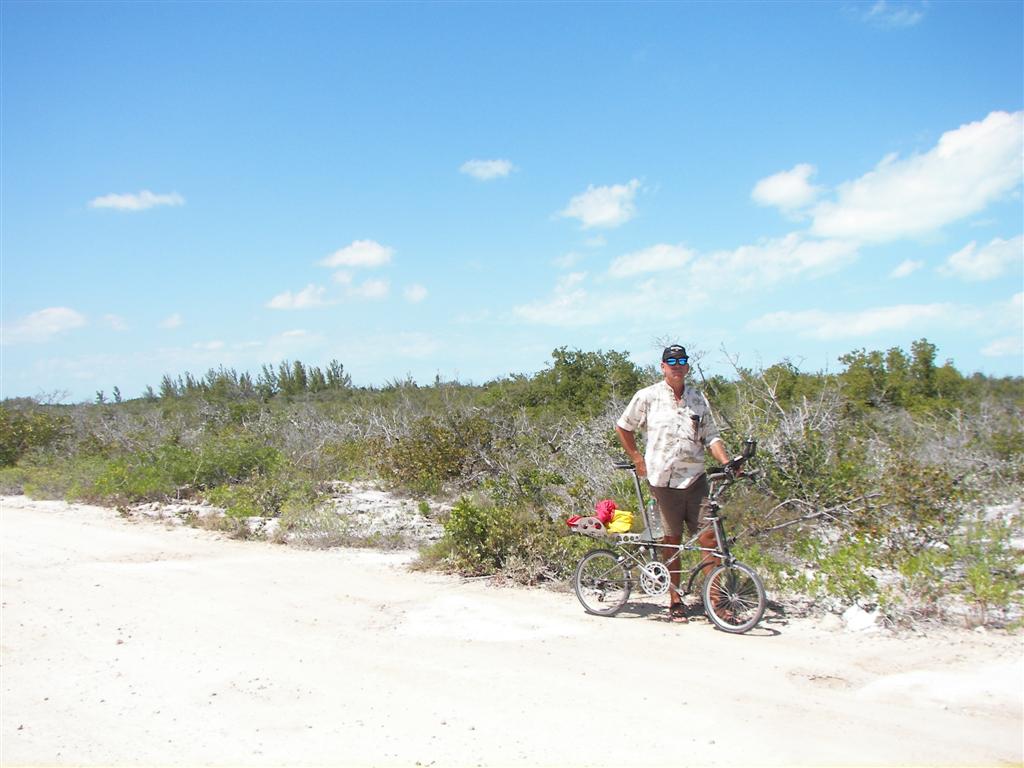
in so the road goes right across. We made the
bike ride to the north tip of Frazer’s Hog seeing the few (very nice) older
homes along the coast. I was struck by the resemblance to the landscape of
Arizona which I was oh-so-familiar with 30 years ago. [Who would name an island
after a pig?]
As you will read, we enjoyed our stay at
Chub Cay, but will probably not make any other Berry Islands a destination
(unless personally invited to dinner by the wealthy owner); only using them for
strategic anchorages on our way to other places.
The Good Peoples Endure.
Didn’t chat with the natives too much as
they were working on the mansions pretty much 24/7. The dock guy at the fuel
dock was nice and the two Batelco dudes in the truck admired our bikes; but for
the most part our friends here were strictly the other cruisers at anchor in
the harbour.
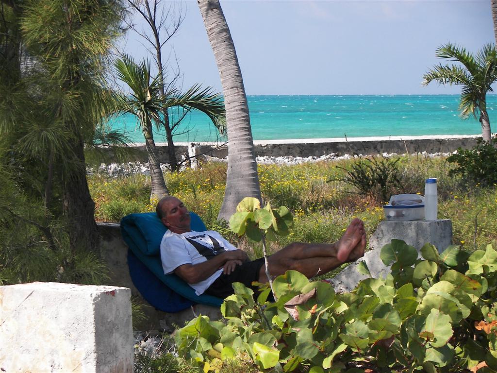
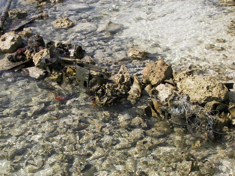
Our favorite time here was camping on Crab Cay (a hundred yards from Chub
Cay and the only trace of peoples here was the abandon house (small fire caused
them to flee) and the millions of conch shells harvested by modern fishermen
and even the ancient Lucayans (there were a LOT of shells!).
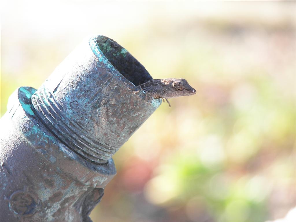
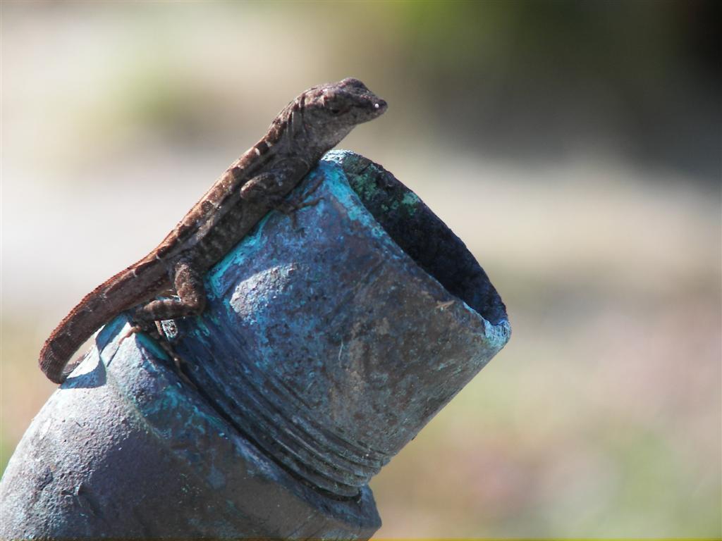
Wildlife.
Karin stumbled upon a panther on one of her
walks to the airport. I wasn’t there to photograph or confirm, but it was a
fairly large gray cat with big ears and a powerful, graceful stride. It was drinking
from a rain puddle on the trail and nonchalantly trotted off when she came
around the bend. We saw cat tracks on other deserted islands.
In the last eletter I asked for assistance
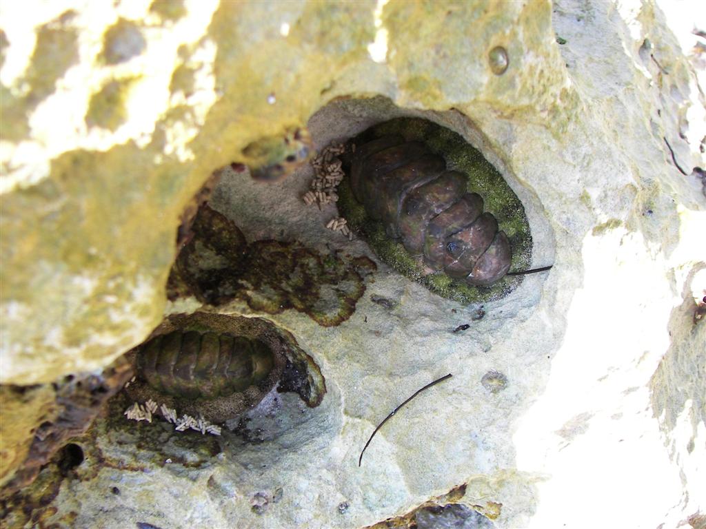
in figuring out the trilobite animal I found all over the rocks on Cat Cay.
They are Polyplacophora and I now remember something from grade school, but a
Travelogue reader and Moulton rider from Austria, Peter Ludwig, came up with
details:
The
Polyplacophora are a class of mollusks (sometimes called 'coat-of-mail shells'
or Amphineura or simply chitons). There are many species both on the shore
and sub-tidally. They are grazers & scrape algal films off the rock
surface. The shell is a series of plates and the 'moss-like fringe' is the
girdle, which is generally tough, & leathery covered by tiny spicules. If
you pry them off, their undersurface is easier to recognize & looks like
that of a limpet.
I didn’t have the heart to rip one off the
rock, as they were too small to eat.
And yes, the pellets in the photo are
probably poop.
Other Activities.
I mentioned camping and you all think, “how
nice” but we were sort of forced to get off Windigo . . .
We were done at our last stop [Cat Cay] and
had a narrow weather window to cross the Great Bahamas Bank and took it. But
immediately upon our arrival to Chub Cay the wind began to veer and intensify.
The harbour is open from the SW to NW so to keep from getting our butts kicked
we set three anchors and abandoned ship. [Cat Cay was an ‘open’ anchorage and
although tolerable, it was not the picture of calm – we were a bit weary of
that.]
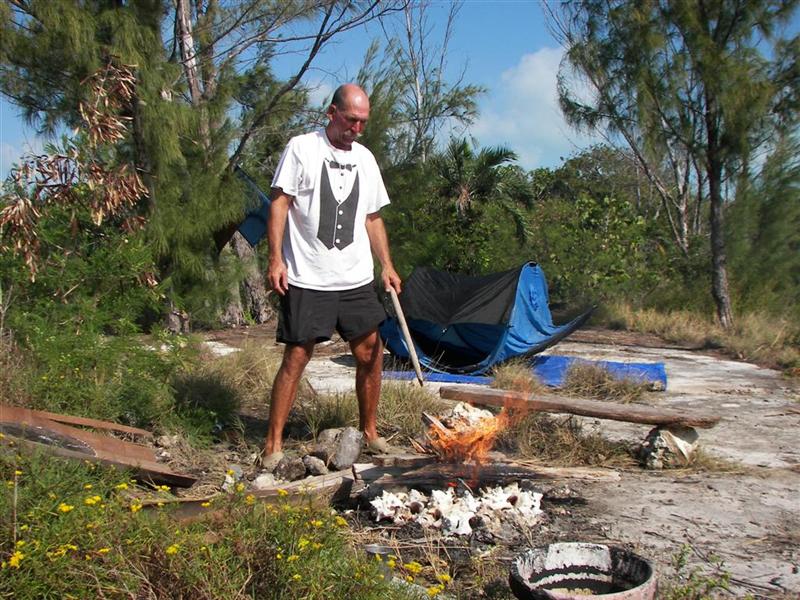
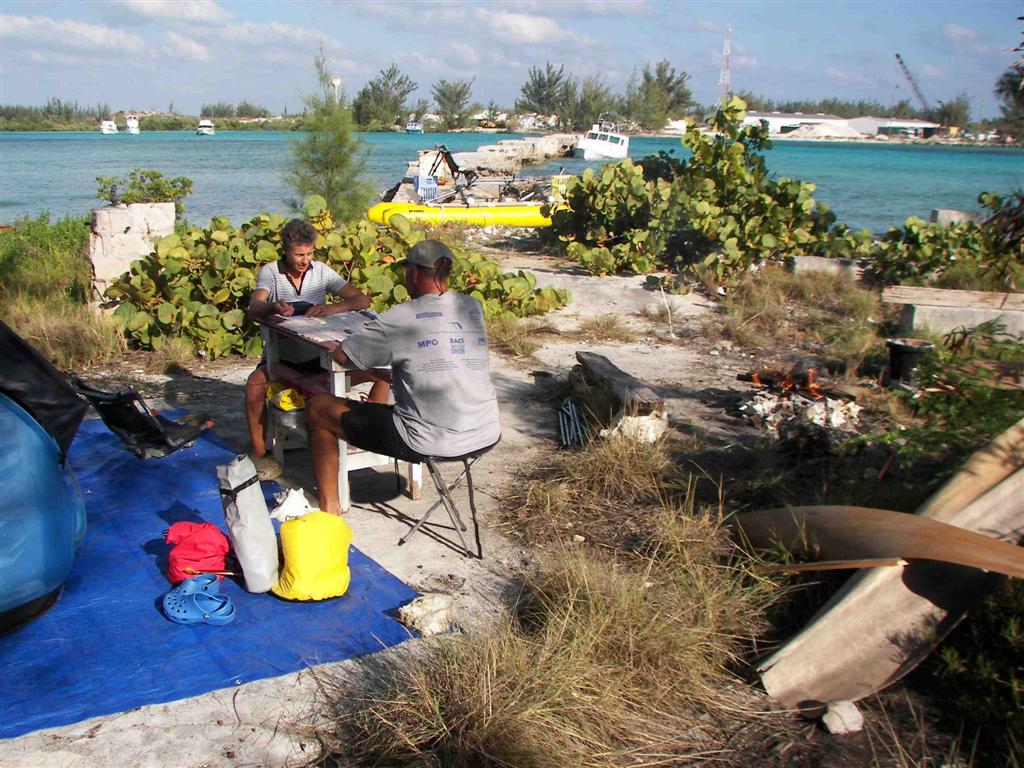
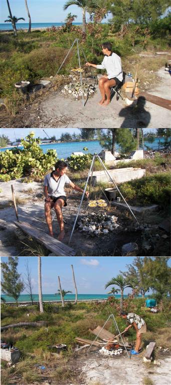
Taking our tent and as many supplies as we
could carry we dashed over to Crab Cay and set up
camp complete with bonfire. VERY calm sea conditions there! We slept right
through the thunderstorms the first night. It took 2˝ days for the wind to do
its thing and we made the most of the vacation with backgammon, nature
hikes, animal training, treasure hunting, and Karin even cooked! Well o.k., I stuck the fork in
her hand while I was cooking and took the pictures ;-]
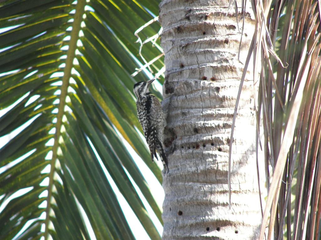
Along with the woodpecker,
there were quite a few snakes on the island, so Karin asked me how to safely
walk through the woods. So I said that they don't like low frequency noise so
she started stomping hard when she walked. It struck me as quite funny, so I
crook an eyebrow and say, “They also hate the sound of Barry Manilow.” I’m
still laughing at the site of her goose-stepping around singing, “Oh Mandy, you
came and gave without taking; And I sent you away, Oh Mandy . . . .”.
It was not only an uninhabited island, it
was an UNINHIBITED island!
Cruising Notes.
This new section is NOT a substitute for
cruising guides; I’ll just try to supplement their information with up-to-date
local knowledge and some tidbits a book publisher may hesitate to print.
Remember: this advice is
FREE, is well worth the price, and there’s a money-back guarantee.
Stay close to Gun Cay when entering the
Banks there; but then head SE to avoid the shallows behind Gun Cay. With our
seven-foot draft, we swung south to about a mile north of Sylvia Beacon, and
then headed straight east along 26ş 30’. We hove to above Russell Light, but
then continued straight for the Northwest Channel Light during the night,
arriving there at daybreak.
A half-mile past the NW Channel light, we
were in 1000 feet of water, and heading straight for Chub Cay. The entrance to
Chub Cay is very short and well-marked. Anchoring is done in that little indent
to the south of the marina entrance. If you draw four feet or less, the “creek”
is another choice; it is the strip of water between Chub and Crab cays. Two
anchors are required in there as the current rips through, changing direction
four times a day. Very calm unless the wind is blowing exactly down the creek.
Access to Chub Cay is made through the
marina. The fuel dock is to the right at the basin entrance. Everyone used the
floating dock at the “Fish Cleaning House” to park their dinghies. There is a
trash can there (don’t ASK about trash or they will feel as though they have to
charge you).
One store is between the dinghy dock and
fuel dock, and the laundry is right next to that store. The other store (more
liquor) is in the Chub Cay Club main building around the other side of the
basin. Mail may be sent at the main office there, too. Wireless internet access
was available everywhere around the basin.
See where Windigo
has been:
http://shiptrak.org/
Enter Windigo's
callsign: W3IGO
Where we are right
now:
Our permanent and
EXACT address:
Capt.KL &
Karin Hughes
S/V WindigoIII •
PMB 365
88005 Overseas
Hwy. #9
Islamorada,
FL 36033-3087
Text-only Email
addresses aboard Windigo, checked daily:
[reliable
communication]
Email addresses
checked when at a land-based computer
(infrequently, but
good for attachments):
And of course, the
Windigo Travelogue Catalogue: