Hi All~
This Eletter with
all the links to fantastic world-renowned photographs, because my good camera
came back from the shop in time to take some pix, is at this link:
<http://www.ciekurzis.org/Exuma%20Cays/Exuma%20Cays.htm>
Just click on it,
'cuz John taught me the <> trick.
Exuma
Cays
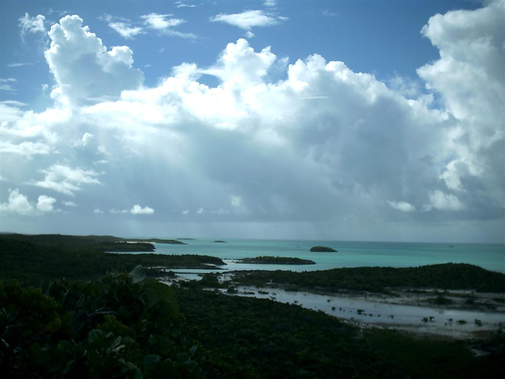
The Exuma Cays make up fully one-half of the chunks of land that are
The Bahamas. Mostly small- to medium-sized islets along a reef of stromatolite
structures on the western shore of Exuma Sound. [Stromatolite is the oldest
type of ancient limestone land structure that is made from sea life.
Stromatolite formation creatures include bacterium that were once thought to be
extinct but have recently been discovered still at work making islands, and
gave rise to the formation of
the Land & Sea Parks in The Bahamas to protect their environment. These
microorganisms are thought to have begun the creation of the Earth's
atmospheric oxygen over THREE BILLION years ago! More information at
http://stromatolites.info/. You know you want to read about the bacteria that
enables you to breath on Earth.]
The Exumas lie on the Great Bahama Bank, which also supports Bimini,
Andros, New Providence, Eleuthera, Long Island, and the Jumentos Cays &
Ragged Islands. The Great Bahama Bank is "S" shaped, encroached by
both the Tongue of the Ocean and Exuma Sound. Three of the tips of the Great
Bahamas Bank have individual names = the northwest tip is the Great Isaac Bank,
the southeast tip is the Columbus Bank, and the rest of the southern edge is
called the Cochinos Bank.
The Abacos Islands and Grand Bahama Island are on the Little Bahama
Bank to the north, separated from the Great Bahama Bank by the Northwest and
Northeast Providence Channels. The only other named bank is the Cay Sal Bank,
bordered by the Santaren Channel along the western edge of the Great Bahama
Bank, the Nicholas Channel along the north shore of Cuba, and the Straits of
Florida through which the Gulf Stream flows around Florida. (Note:
"cay" is pronounced 'key' and means "small island") Cay Sal
Bank supports several TINY cays, none of which are inhabited.
?[I have been to the one named
Cay Sal, and man, it is SMALL and ISOLATED!]
Crooked Island, Long Cay, and the Acklins Islands are inhabited and
occupy a bank almost as large as Cay Sal Bank; it is unnamed except to be
called "The Bight of Acklins". (Anywhere the curve of an island holds
shallow water, it is called "The Bight" and there is always a
settlement there called "The Bight".*)
There are a couple other named 'Banks', but they do not support islands. The
remaining Islands of the southeast Bahamas stand alone in the Atlantic Ocean;
they have aragonite, stromatolite, and coral reefs near them, but no extensive
bank. [These "Out Islands" will be the last stops for us in The
Bahamas ? detailed in the next eletter.]
*The naming conventions in The Bahamas are uniform in the fact that
there is none observed. Rocks are named whatever the peoples wish to call them,
until other peoples decide to call it something else [my favorites are
"Kick 'Em Jenny" & "Killum Poly Rock" in the Abacos].
Sometimes the government renames some place ? if the peoples don't like it,
they continue calling it the name they prefer. Because of this absence of
order, some things have six or seven current names. EVERYWHERE has at least two
names! and then there is the opposite effect = there are 18 "Sandy
Cays" I have counted and a dozens of "Crab Cays". Settlements
are named after founders, trouble is, there was a limited number of founders,
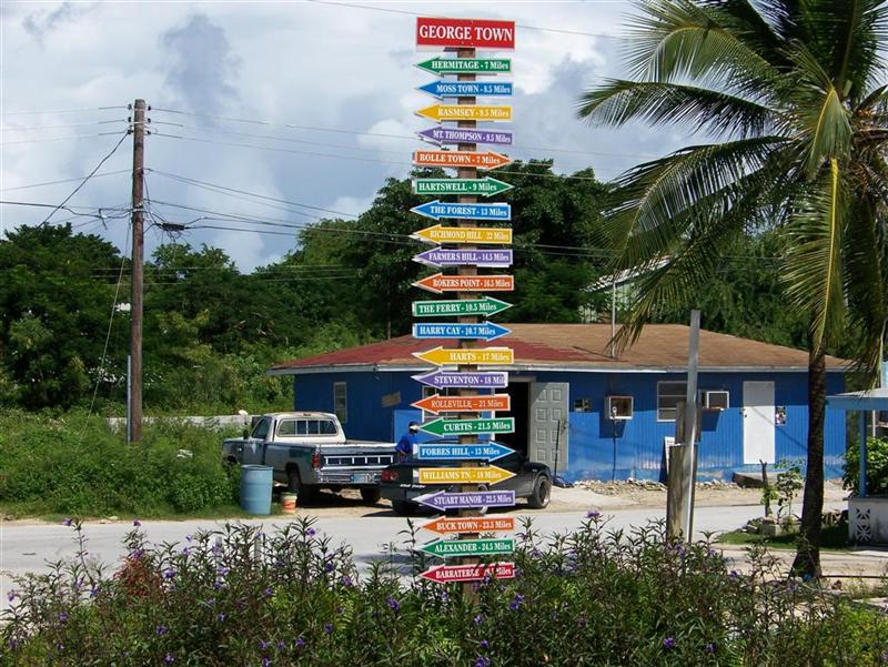
mostly related. So if you turn left at George Town, you will get to Rolle Town;
if you turn right, there is Rolleville. The two larger towns in the area named
Cockburn Town are differentiated by everyone pronouncing one of them COburn
Town ? the other one is in the Turks & Caicos, another country! Every
'Island' has a 'Cay' with the same name somewhere else.
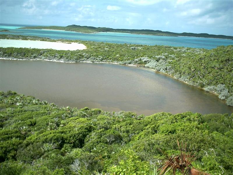
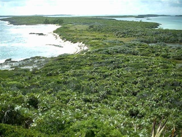
The Character Of The Land.
Besides discovering the stromatolites, the Exumas presented themselves
as the typical string of islands as we have seen along the edge of a shallow
bank in The Bahamas; ordinary in formation, but unique because of position and
logistics.
The Exumas have enough good-sized, isolated islands to have been of
great use to drug runners during the last century. Any island over a half-mile
long has an airstrip and at one time was ruthlessly controlled by a drug lord.
Two Land & Sea Parks, the Exuma Cays LSP
and Moriah Harbour Cay LSP, protect large areas of the Exumas by having a
"no take" policy. Fishing or removal of ANYTHING from these parks is
prohibited.
The settlements in the Exumas are about the same distance apart as in
say, Eleuthera or Andros, but are a bit more isolated as they are each on a
separate island, islet, or cay. (Except for Great Exuma and its bridged
neighbors- Little Exuma, Madame Dau's Cay, and Barraterre.)? Even Great Guana Cay has isolated
settlements because its rugged ten-mile length has yet to be completely joined
by a road.
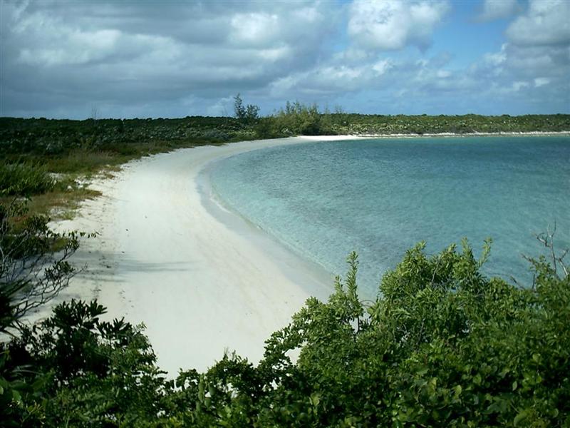
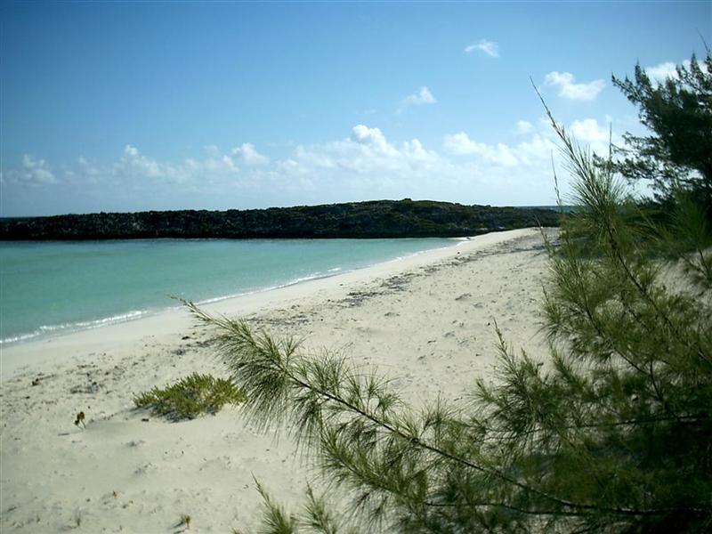
Some of the most natural beauty of The Bahamas, both above and below
the water's surface exists here in the Exumas.
The Good Peoples.
More delightful Bahamians. More gazebos, more domino games! More
'private' and 'exclusive' cays, but we were always welcome to walk or ride the
roads and beaches (what gorgeous beaches!). While cycling any island with more
than a couple miles of roads, I never felt unwelcome. Karin, on her exercise
walks, had to turn down many, many offers to give her a ride. There are always
locals out for short strolls, but I saw more bicycles being used here than
other places in The Bahamas.
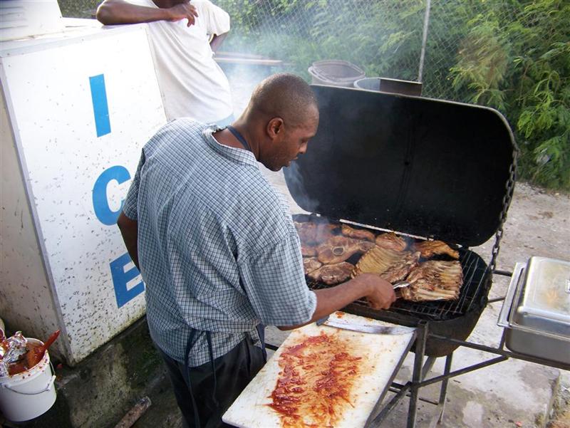
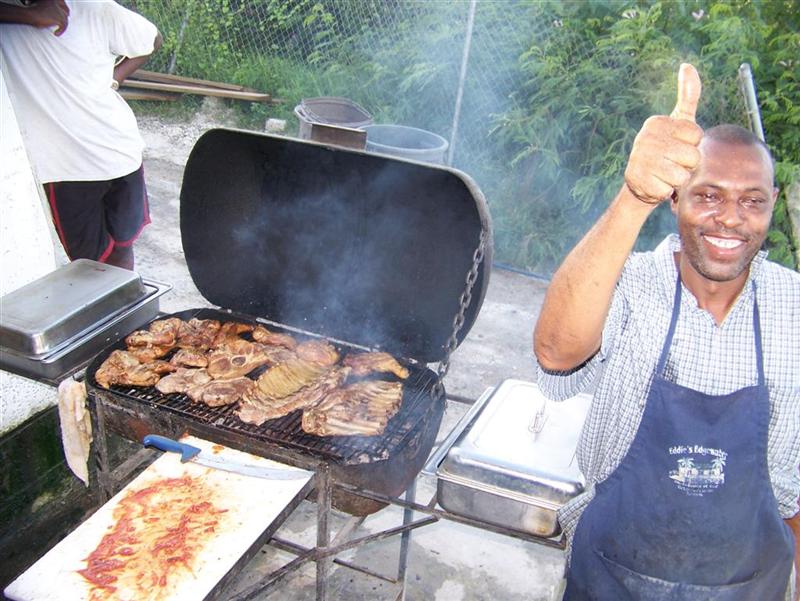
We also were drawn to Eddy's Edgewater in George Town; at first for its
free wireless I-net access, but later by Kevin's
(the owner) fantastic ribs, chicken, & pork and Darlene's (his wife)
charm- and their adorable kids! The I-net access is all the time, but you gotta
be there on Friday night for the ribs &
chicken!
The Trip.
The Voyage From Abaco To Exuma. [click for simple map]
![[click for simple map]](headsouth.jpg)
From our staging point just above Little Harbour Channel at Lynyard Cay,
Sea of Abaco, we headed down across Atlantic depths of over two miles to the
islands north of Eleuthera, entering the bank at Egg Island and scooting into
Royal Island Harbour. Much has changed there since we last saw it in May; the
writing is on the wall that the place will soon be "officially" off
limits or made so uncomfortable by contractors orchestrating the development of
this gorgeous island and wonderful harbour for cruisers to be anchoring there.
Maybe not?
From Royal Island we sailed along the Northeast Providence Channel and
onto the Great Bahama Bank at Fleeming Channel, my first time through there and
a painless way to get from North Eleuthera to the Exumas. Great care must be
used crossing the Middle Bank once among the coral heads, but it is as easy as
the Yellow Bank used by many.
Traveling the length of the Exumas. [click for simple map]
![[click for simple map]](excruise.jpg)
Highborne Cay was our first stop: the first large inhabited cay of the
Exuma chain. Nice anchorage for the prevailing easterlies, shallow bays for
north or south wind, great marina for anything else. We were allowed to leave
our dinghy at the marina, but it was empty as the 'season' was still a month
away. Highborne Cay certainly had it's own
flavor, with even a rapid transit system (o.k., maybe not THAT rapid). I did notice that
although still part of a "developing" country, some of these remote
islands are executing better construction plans than even Florida in regards to
infrastructure in an area subject to tropical weather. You see, the backwards
utilities in Florida still install and maintain a mostly above-ground
electrical system, allowing for the slightest weather disturbance to cause
outages. On Highborne Cay, they
are burying their electrical distribution, at a slightly greater
installation cost, but with hurricane-proof results. Very smart.
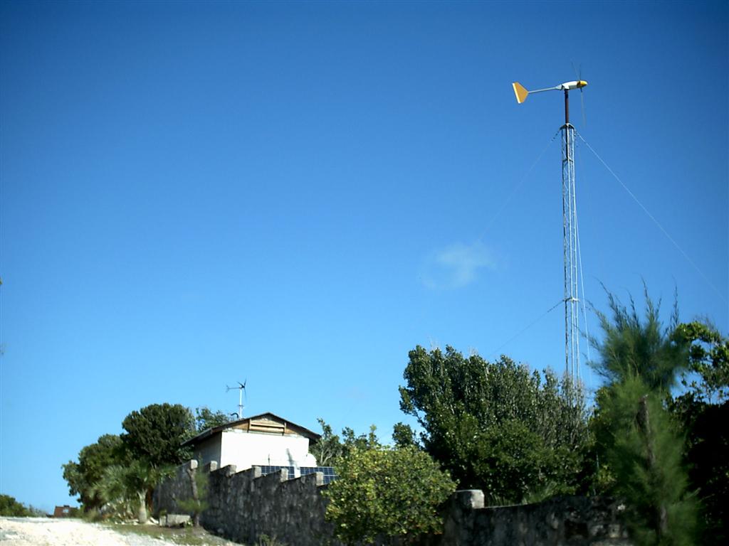
Norman's Cay is the former home of Carlos Lehder: a well-known notorious
drug lord. This made the island quite "private"! It is now mostly
privately owned, but by a friendlier lot. Reefs & rocks for snorkeling all
around; plenty of anchoring choices, including completely protected Norman's
Pond ? if you can get through the intricate entrance that is two-feet deep at
low water; ruins to explore; and a paved road that offers great cycling access
to the entire island, even if it peters out considerably on the eastern half of
the island. Norman's Cay also shows it is looking to the future in regards to
wind-generated electrical systems.
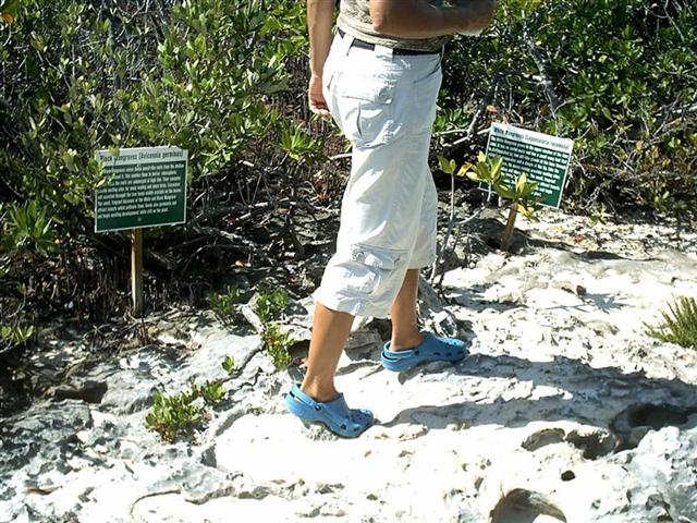
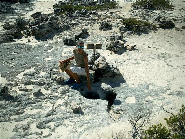
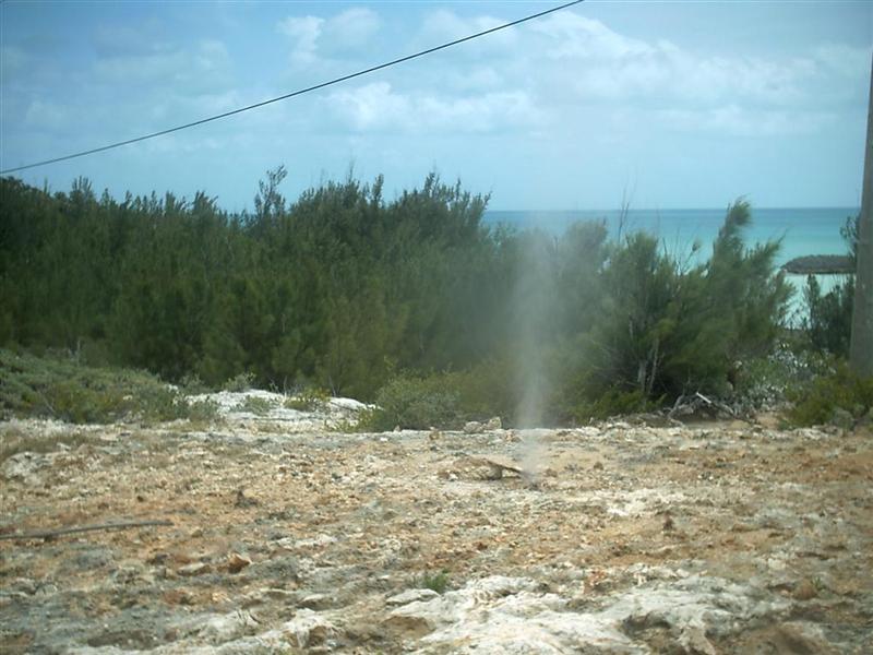
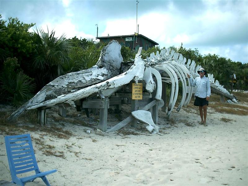
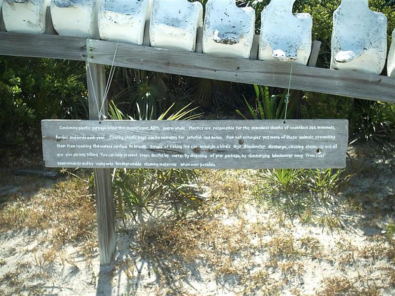
Warderick Wells,
the location of the office for the Exuma Cays Land
& Sea Park (ECLSP): several mooring fields, with free anchoring
permitted by Emerald Rock. Marked hiking trails; nature walks with signs
identifying all manner of natural things (including more of the geyser-like blow holes as I
showed on Eleuthera);
phenomenal snorkeling; an interesting gift shop; skeletal
remains of a 52' whale (unfortunately killed by PLASTIC TRASH); super
beaches; and a "high" point, Boo
Boo Hill. Interesting that some of the hiking trails take you from one cay
to another ? prepare to get your feet wet! I have never heard of some of the
unique books in the gift shop.
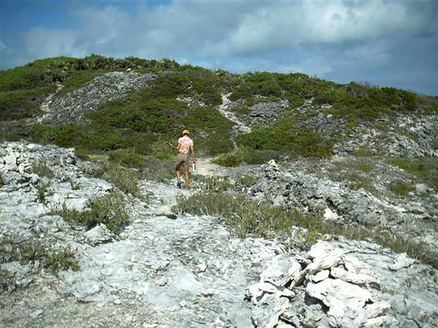
At Bell Island, off Cambridge Cay: we had to move from the SW corner to
the NW corner of Bell Island due to swells caused by unsettled weather, as we
were unwilling to navigate shallow intricate paths to better anchorages near
Cambridge, O'Briens, Soldier, and Little Halls Pond Cays; but it seems one
could find many great anchorages in normal conditions. We took Pedigo around to Cambridge Cay and
hiked the large hill on the north end,
searching for a geocache.
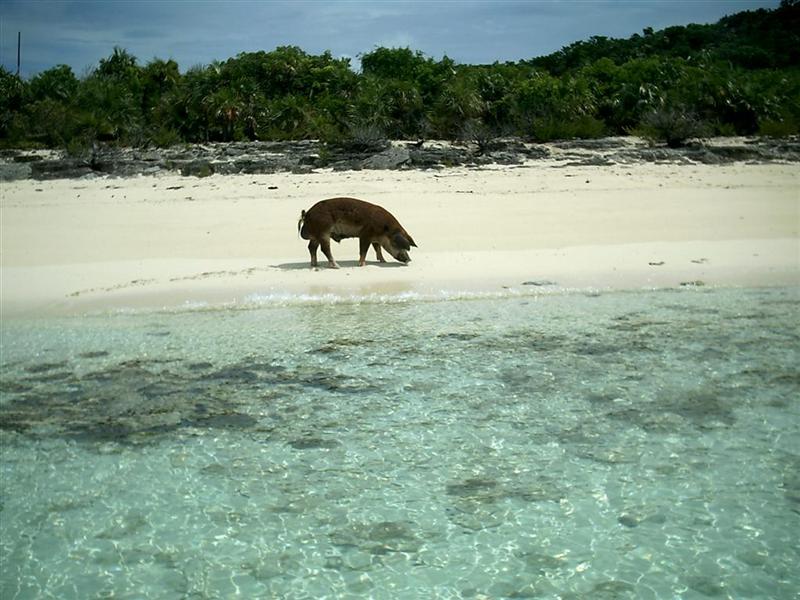
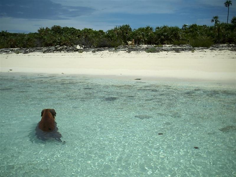
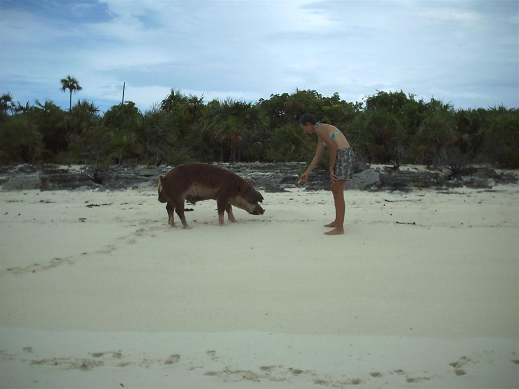
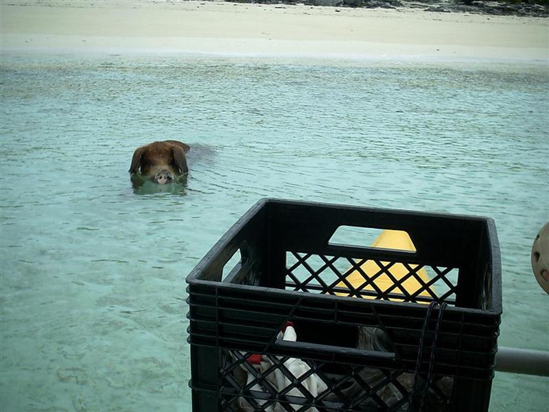
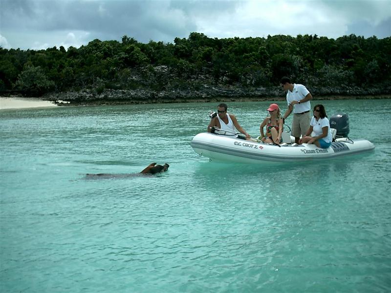
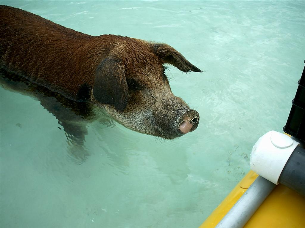
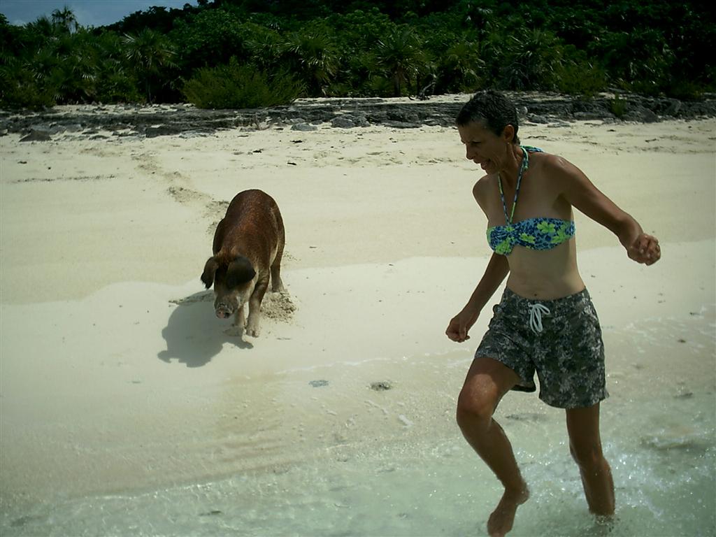
Big Majors Spot is the finest anchorage we had in Exuma: with the finest pig we have seen in The Bahamas. There are also many goats along with the smaller reptiles,
crustaceans, and amphibians. From here, it is a short dinghy ride to Staniel
Cay, with the Thunderball Grotto in-between. (Yes, it is the underwater cave
from the James Bond movie; be sure to time your visit there at slack low
water.)
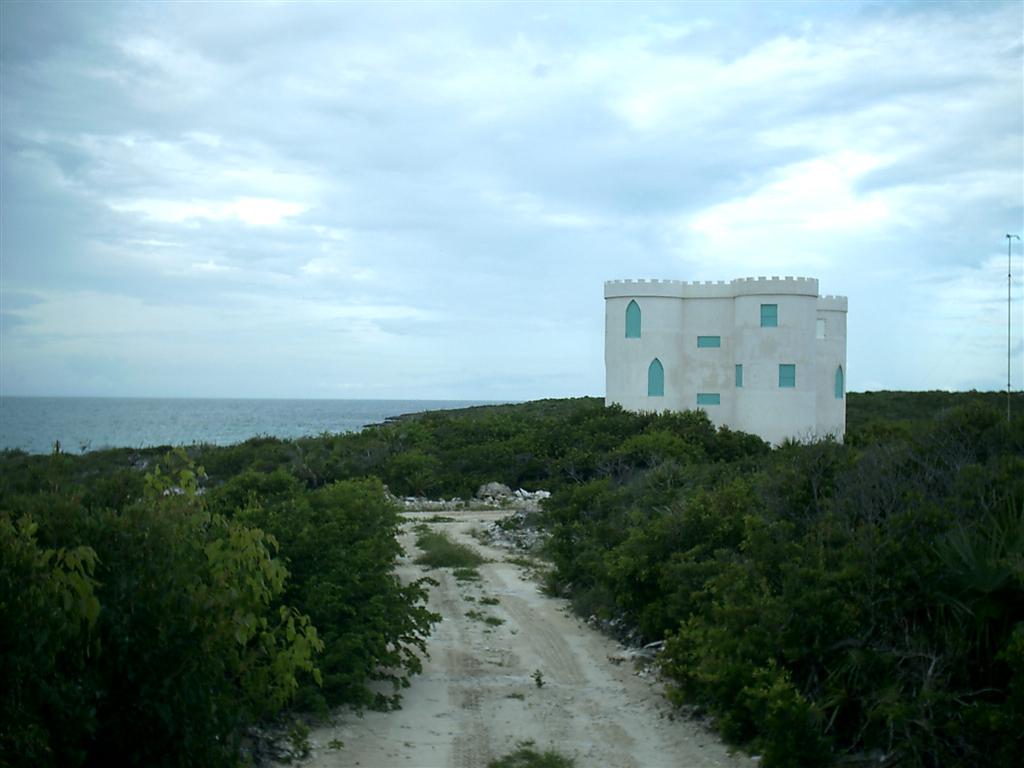
Black Point Settlement on the north tip of Great Guana Cay: the first
traditional Bahamian town encountered in the Exumas, it has extensive development going
on in its southern extremities. (Including a castle!)
Little Farmers Cay is another traditional settlement: the normal passage
out to Exuma Sound for the trip down to George Town. We walked the entire
island and stayed a couple days before continuing south on the bank.
Williams Town South, Little Exuma Island: this was as far as we could go
behind Exuma Islands before anchoring to sleep and wait for tides favorable for
us to pass through Comers Channel and around to George Town. The Williams Town
Homecoming celebration was in full swing on the Friday night we were there, as
the music was clear from the town TWO MILES away! If we weren't in the middle
of a passage, we would have gone in to party.
I also cycled to Williams Town once we anchored in Elizabeth Harbour and
found it to be a very quiet and
small community. From the looks of closed businesses, it appears to be
getting smaller. This is what I have noticed in my studies of all communities
on our upcoming tour. The SE Bahamas have experienced severe population decline
in the last few decades as young people go off to college and seek their
livelihoods elsewhere. I will present more details in the next eletter.
We pulled into George Town and parked by the medical clinic (see
Cruising Notes). It turned out that this was the best spot for Windigo's
draft; just off the Peace & Plenty Hotel and around the corner to the
entrance to Lake Victoria. George Town has marinas, boatyards, grocery stores,
good cycling roads, and many, many places to anchor and explore in the area. It
is a hub of activity throughout the
winter cruising season.
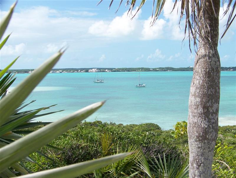
Stocking Island spans
the eastern side of Elizabeth Harbour immediately
across from George Town and is ground zero for many of the cruiser
community's activities. We hiked to the summit of the highest hill within 30
miles, the base of the stone beacon known as the Monument.
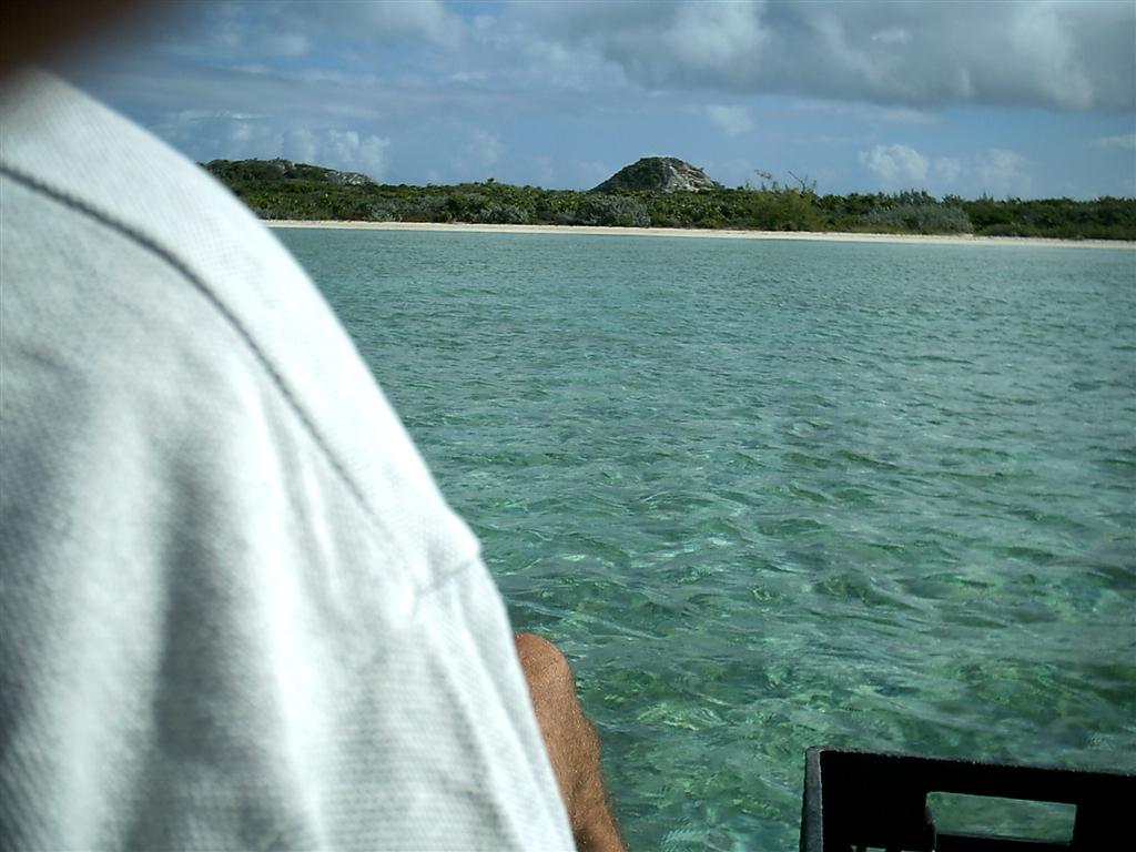
There are hundreds of places in between our stops to anchor, snorkel,
paddle, hike, or just dinghy around the beautiful rocks, beaches, and bays. We
had limited time for this portion of our journey [I will explain in the next
eletter] and so our targets were convenient anchorages, cycling access, and
BaTelCo tower logging. Some cruisers only come to the Exumas, and I can see how
they are captivated by the beauty of the hundreds of small islets in the chain.
Wildlife.
Full variety of lizards, with huge iguanas now joining the large
curly-tailed ones and the small Anolis carolinensis, just like the ones
on Florida. The abundant reptiles are living along with a greater number of
snakes and frogs. As I mentioned above, large mammals are becoming more
evident, with pigs & goats galore. Many times sailing between the islands,
especially in a rainstorm, will attract a weary bird which will rest aboard for a while,
fly in the rigging to say goodbye, and then continue his travels.
At the beach of Big Majors Spot, Karin
tries to make friendly with a boar, it decides she is worth pursuing - all the way to Pedigo! It seems this pig tries to board any dinghy
that ventures close. Good thing Pedigo is strange enough that he didn't know how to get on and pedal!
Other Activities.
More geocaching lead us to our first unfound treasure...unfortunately,
even after wading along several hundred feet of shoreline in a salt pond
and crossing dense wooded areas, we didn't
find the cache due to my GPS programming error. It made for an strenuous hike
up a steep slope through dense vegetation, and although I walked right by the
place of the actual cache, we did not find it. Karin's Poisonwood scars will
cause her to recheck EVERY coordinate before our future geocaching escapades.
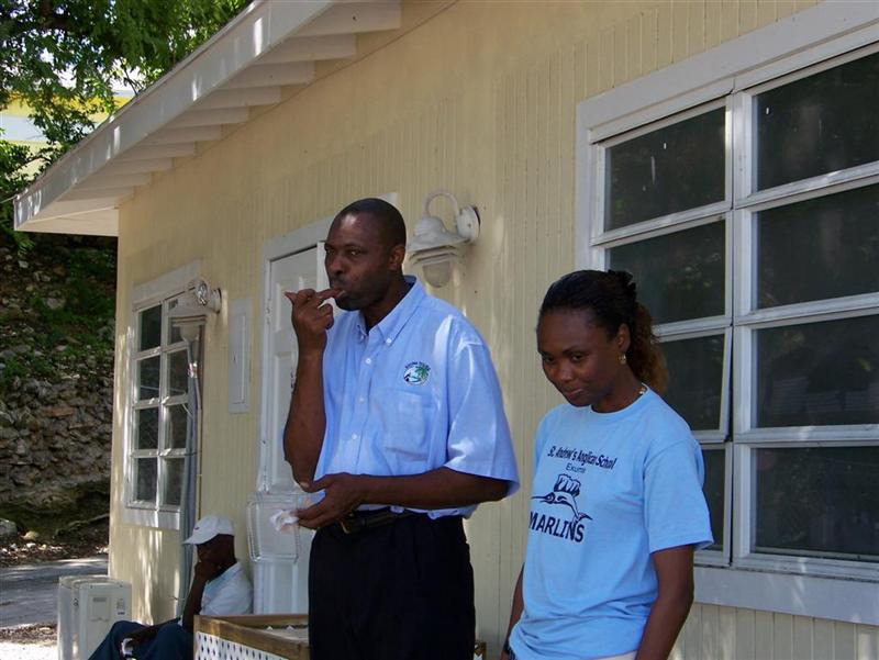
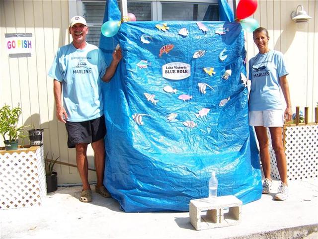
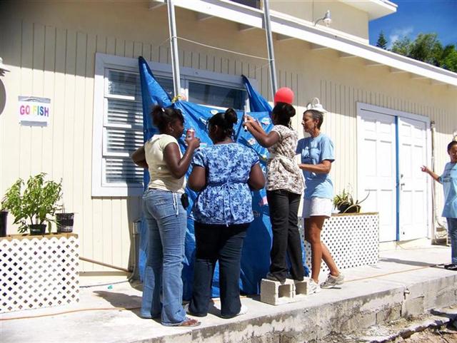
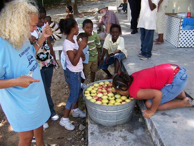
Darlene (from Eddy's Edgewater)
asked us to participate in the 1st Annual St. Anthony's Anglican
School Festival, a fund raiser for the private school in town. Karin and I
created the Lake
Victoria Blue Hole, a "newly discovered" phenomenon that produces
unusual treasures when fished with the proper gear (all created with stuff from
Windigo).
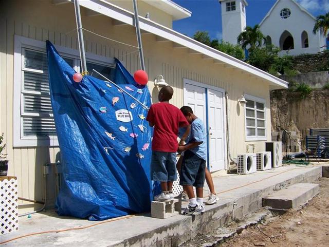
The school kids would haul in
toys, bags of candy, snacks, blocks of wood and old coconuts from the fishing
game. BLOCKS OF WOOD AND OLD COCONUTS??? Yes, we
teased them once in a while, but allowed a free turn later when they scored
a booby prize. J
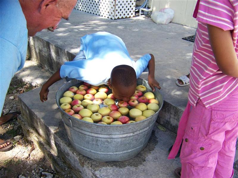
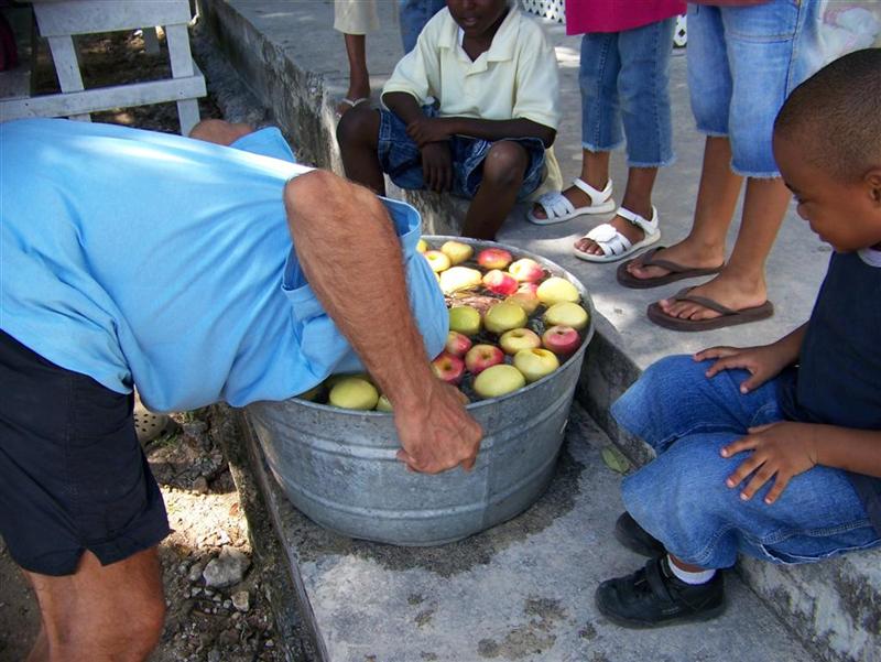
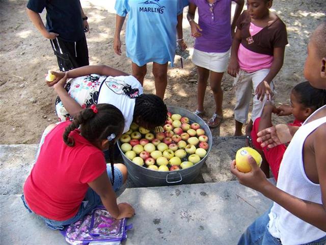
Another unique experience for most of the kids was bobbing for apples,
in ice-water just as in the Pineapple Festival in May at Gregory Town. (Did I
tell you that I was on Bahamian National Television bobbing for apples in
Gregory Town?) After some kids tried
either too daintily or with the wrong
technique, Capt. HeadSoaker stepped in to
show them how it's done ? first time / every time!
It turns out that Capt. SoggyBrains was showed up by a talented girl that could finesse the apples
into her mouth in a very feminine fashion, and taught her friends to do so,
too.
In the end, there was a lot of laughs and a lot of candy [and apples!]
were eaten for a very good cause. Between the apple-bobbing and fishing hole,
$300 was added to pay for the operation of the St. Anthony's School. Father
Mario was delighted with the help from the cruiser community. [Father Mario
went to seminary in Nashota, Wisconsin, a place I frequently cycled and not far
from where we lived.]
Girlie Stuff.
I know that most people find the Exumas to be "thee perfect
place" but I guess I've seen so many other Bahamian islands that these
were not my favorites. I did meet some nice people which is always my objective
while walking through the small communities and we encountered another cruising
couple that seemed to be going in our same direction which was always a welcome
sight. But the communities were very small and the sparsely populated main
roads were boring to walk because of the high dense trees which hid the rest of
the scenery.
I also realized that I love encountering animals from AFAR. I've always
had a fear of them because they respond to situations unpredictably, even
domesticated dogs and cats. Seeing a wild boar on one particular island had me
so excited that Kevin suggested I go over by it and pretend that I have food so
that he can take a picture. I jumped off Pedigo, easing my way towards the pig.
In horror, I watched this huge thing turn and starts charging towards me (what
was I thinking!). Well of course
I screamed and ran towards Pedigo, yelling "hurry get out of
here"! Kevin was laughing soooo hard that he couldn't maneuver Pedigo out
of danger's way, but when I realized that the pig wasn't dangerous and my heart
settled down, I was laughing also. I guess from now on I'll just stay back and
admire what probably wasn't meant to be disturbed anyways.
I felt very vulnerable to outside influences in this area; out here all
alone and sometimes not a soul to be found. This was especially true when Kevin
hurt himself (see his story in Cruising Notes). He was so
calm and just "took care of business" but I was a mess. Just watching
him try to get us to our destination while turning white and pale, seeing the
blood continually seeping through the many layers of bandages and trying to
keep his finger held above his heart and being very, very quiet (this is when I
realized that he was in severe pain)! Of course, he tries to act as if nothing
is wrong but after 11+ years together, you get to know how to read a person.
Finally when we got to our destination I was sort of relieved. I realized that
the treatment was cheap but sanitary? I would doubt it, as it had rained for a
few days and there was a couple inches of standing water on the clinic floor
which had a rust tint to it. The lights went out while the Nurse [Cratchett]
tried to stitch him up using a Coleman camping light and she kept breaking
needles on him. Seeing the extent of his damage caused me to almost pass out so
I had to leave ? what the heck was I going to be like when I HAD TO BE THE
NURSE!? Thank goodness it's healing well and Kevin is a good EMT and patient.
We had another small incident which caused our water supply to be
contaminated with wonderful salt water. When we collect rain water sometimes we
leave the fill drain open on the deck of the boat. Well it had rained the night
before we were to leave, so the drain was open when we left in the morning. We
were pounding through the seas when all of a sudden Kevin noticed that the
drain fill was still open. I quickly closed it and then went inside to taste
our water ? it was salty! Sooooo I had to drain the tank (50 gallons), wash it
out and find 120 gallons of FREE water to refill it. When we got to Georgetown
we found the free water on the Exuma Market dock. We had to haul it back and
forth to the boat in barrels and bags. A lesson definitely learned ? the hard
way!
Now that I'm writing this I have determined that maybe it wasn't the
islands at all that caused me such an indifference but was probably the
anchorages. We were further away from land than in previous island chains,
which causes the water to be a bit more choppy, which then caused the boat to
rock & roll, which then caused Karin TO BE SICK! In higher winds and seas I
found it hard to maneuver Pedigo and would find myself going around in circles
just to get to land and back, sometimes needing Kevin's pedaling (and weight)
help to fight the cavitation of the propeller.
I don't want to say that the Exumas were THAT bad because I did enjoy
our time in George Town where we went out to eat, helped with the fundraiser
and I hung out at the library and met some neat people. Maybe there were just
too many bad incidences that curbed by appreciation of the area. I will rethink
my opinion when we head back there to pick up a package in a couple weeks to
see how the cruising population has grown and say our formal good-byes.
[We came (sailed right to our old anchoring spot), we saw (fun watching
and listening on the radio to all the cruisers), and we?.WONDERED? Why didn't
all these people just find a beach in Florida to meet up and party because they
stay grouped together in an area away from the locals anyways. There are many
"cruiser" activities going on and they were even having their own New
Year's Eve party. It seems like the cruisers only use the locals for personal
needs and some local people seem very standoffish and even angry when we tryed
to talk to them. I guess we'll spend New Year's partying Bahamian style trying
to break down the wall a bit.]
Cycling Notes.
It was worth cycling on Highborne Cay, Normans Cay, Black Point
Settlement on Great Guana Cay, and Great & Little Exuma Islands. While
Warderick Wells, Cambridge Cay, Staniel Cay, Little Farmers Cay, Stocking
Island were small enough, and lacked paved roads, that hiking was sufficient to
cover the entire area.
While much more limited than Andros, Eleuthera, or Abaco, cycling most
of the Exumas provided me with exercise and allowed me to range the extent of
the islands. Great Exuma required the bicycle, and had a moderate terrain
providing a few days worth of cycling adventure, along with a geocache, parcel
pick-up at the airport, and six BaTelCo Towers to locate.
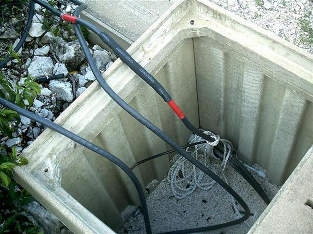
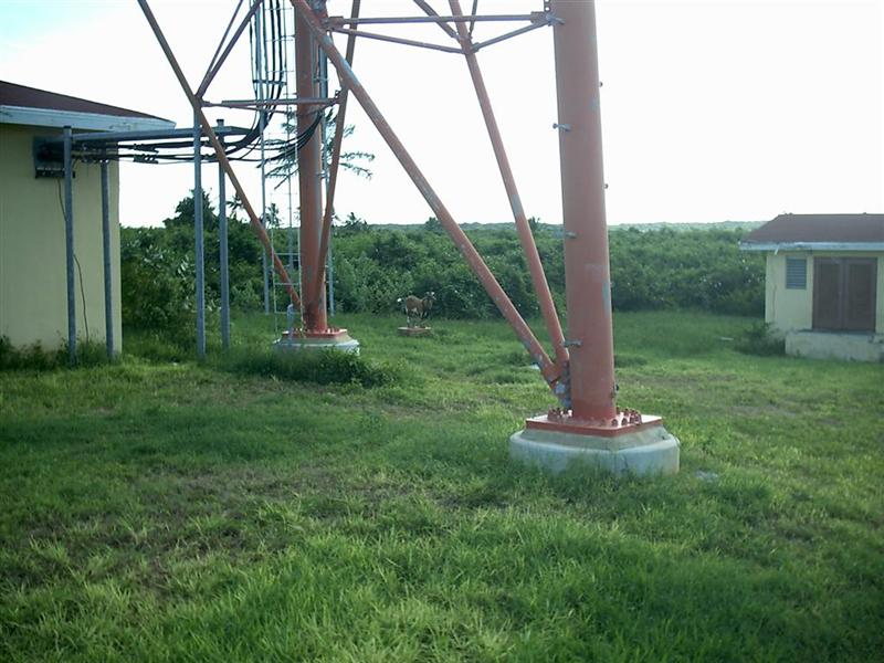
Something I may have not mentioned yet is my BaTelCo Tower logging
hobby. Because The Bahamas are very flat, the most useful visual navigation
aids throughout the country are the Bahamian Telephone Company cellular towers.
One guide we have lists the coordinates ? completely inaccurately! So from the
beginning, I vowed to record the proper position of each tower, by hand,
accurately. So far, I have identified the correct location of 70 towers, with
12 to go. There has been 10 I could not confirm, either on Grand Bahama, which
we will not visit (but we came close enough for me to confirm one there), or
way south on the islands of Andros, and two on Abaco that remained unvisited
because the weather caused me to miss my ride to the south tips. I will share
the coordinates of these towers with the cruising guide publishers to assist
future sailors.
Cruising Notes.
Of great note is the cruising community at George Town, Great Exuma
Island. Unfortunately, I cannot tell you the scope if it first-hand, because we
sailed through there during the off-season. Although there was 10 to 20 boats
scattered throughout Elizabeth Harbour during our stay, in the 'season' there
are over 400! For Regatta, the number of anchored boats may exceed a thousand!
Many cruisers come to The Bahamas just to sit in "Chicken Town" for
the season, and then return home to the US. The unwillingness to venture
offshore into the ocean, persistent trade winds, and rest of the Caribbean
islands (some utilizing foreign languages!) earns it the nickname.
[NOTE: We passed through George Town a second time, later in December,
and witnessed the growing numbers of cruisers. Although unique and interesting,
we preferred the less populated version. Some of the people on boats seemed
less like cruisers and more like landlubbers on vacation: radio etiquette is
appalling; self-understanding of weather is lacking; and a dependency on others
for technical information, skills, and entertainment abounds. But there's
cocktails parties every night . . . if that's what your about, it's great.]
It was mostly quiet and secluded for us, although we made friends with
another cruising couple that is in the final stages of refitting their boat,
just as we did in Door County seven years ago. We also met Mike Minns, the
owner of Exuma Markets, a VERY cruiser friendly store. Mike maintains a dinghy
dock just inside the inlet to Lake Victoria (where the store is located). He
provides free RO water, at the dock, for cruisers. He told me that earlier
this year he counted 140 dinghies connected to the 30' dock! He described it as
a good-sized island of boats. Exuma Markets will also accept and hold mail for
cruisers, allowing shipping to a physical address for delivery services that
demand it.
An alternative that may suit cruiser's needs in Exuma is Reggie Express
Services, Inc., an air transportation company out of Ft. Lauderdale. They will
bring packages from Ft. Lauderdale to the Exuma International Airport very
inexpensively. Call 954.761.3131 for information, or email Regina at reggiexp@bellsouth.net, as we did, to
arrange fast , inexpensive transport of parcels from Ft. Lauderdale to George
Town.
As I mentioned, free wireless I-net access is broadcast at Eddy's
Edgewater as a cruiser service. The only other places with wireless access in
the Exumas that I noticed were the Highborne Cay Marina, which they are very
stingy with (and it was inoperative during our stay); and the ECLSP, although I
didn't ask or use it, but in an emergency, I'm sure they would offer it. I
sought signals in other places, but was content with the SSB email for weather
and short messages; there is too many beautiful things to see and do to be on
the damn computer!
Water was also more scarce in the Exumas, but we had plenty between
rainwater we caught and the Exuma Market faucet in George Town.
We anchored out at all the places we stayed, even though it is said
anchoring is prohibited in some places. The prohibited place mention most often
is the ECLSP, but the ranger there allows anchoring just outside the mooring
field at Emerald Rock (most of which inside is too shallow for us, anyway!).
Anchorages were secure and comfortable [with one exception] ? we had to
move around the end of Bell Island to avoid swells when there ? with Big Majors
Spot being a standout favorite. Big Majors Spot is right next to Staniel Cay
and Thunderball Grotto, two very popular sites to visit.
Another outstanding spot are the Caribbean Marine Research Center
moorings at Lee Stocking Island. But you better hurry to assure a free landing
here: the political climate is closing this US-run facility and the free
moorings will be gone. Access to the island is already restricted and tours are
no longer allowed due to lack of personnel and a total absence of scientific
research.
It seems that the current administration is more interested in killing
for oil than studying sustainable food sources and renewable energy supplies;
but then, why would oil barons care about that stuff?
The exception being Steventon, which IS marked as a "day"
anchorage. The swells were untenable on the windless day we tried to stay
there, even though there had been no large seas for several days. The entrance
is as tricky as any cut in the Exumas.
We choose to do the unorthodox once again and instead of traveling out
in Exuma Sound to get to George Town as most cruisers do, we sailed around the
west and south sides of Great & Little Exuma Islands and came around to
George Town through the western extremities of Long Island Bight. This was
another rewarding shallow-water navigation experience in our deep-draft boat.
One of the rewards for me personally was a crushed finger due to a momentary
burst of strength with a simultaneous lapse of judgment.
The anchor was stuck on a rock and refused to break loose from our
overnight resting spot south of Williams Town. This was an open anchorage with
steady moderate swells that made Windigo's bow move up & down a foot or so;
not a calm sea, but easily tolerable for the one night.
Well, when Karin asked for assistance at the bow while doing her customary
anchor-weighing tasks, because the anchor was so firmly buried in the deep sand
and it found some coral/rock to increase its grip on the earth, Captain Muscles
comes forward to assist (take over) and get us underway.
The bouncing ten-ton vessel, three-eights chain, and seventy-pound
anchor conspired to trap his finger for the briefest moment. That is all it
takes to crush the soft tissue across the smallest knuckle (is that the
"first" or "second" knuckle?) and fold the bow roller over
the end of the boat. Captain Toughboy gets the anchor aboard, then runs like a
baby to the medical clinic. Unfortunately, the medical clinic is 44 miles away;
that's 8 hours in a sailboat, you know.
Upon sailing for seven-and-a-quarter hours in intense pain, because he
doesn't want drugs clouding his judgment at sea, Captain Onehand just gets
Windigo into the maze of coral reefs outside Elizabeth Harbour, and then some
mysterious problem causes the thermal breaker for the engine electrical wiring
to trip, taking out the fuel pump and causing the engine to stumble and die.
(It turned out to be a tiny short in a tiny wire for the illumination of a tiny
gauge. The most insignificant electrical apparatus can cause engine failure!)
As Karin is reworking the secondary ground tackle at the bow in
preparation for anchoring without our main gear due to the crumpled main bow
roller, Captain Bloodgusher hot-wires the fuel pump while floating amongst the
coral heads, gets underway, and manages to anchor 400' from the medical clinic.
The nurse was in on a Sunday evening(!) and called the Doctor for
evaluation of the damage and after a little quick prep surgery (trimming of
loose tendons, ligaments, and such) she stitched Captain Crybaby's finger into
a shape similar to that of the blue-butt baboon (which serves him right).
At the end of the day, everything is copasetic aboard Windigo, except it
will get pretty stinky by the end of next week 'cause Captain Whiner can't go
swimming 'til the stitches come out.
[NOTE: An emergency room bill in Clearwater, FL - for Karin to sit on
the end of a bed fully clothed for 2 hours after the ambulance crew treated her
for the kidney stone she passed enroute to the hospital - was $5000.00 (the
hospital staff did nothing but ignore her).
The bill for the Sunday evening rousing of a nurse and doctor, two
sterile cleansing kits, five suture kits (she said the tough tissue of my
finger resisted needles and kept breaking them), a week's dosage of Cipro, and
follow-up visits for dressing changes amounted to $60 in The Bahamas. Don't
fret America; reasonable health care is but a country away!]
Two things I can relay from this incident, and are a huge part of my
sailing classes = first, carry complete medical supplies aboard to suit your
every conceivable need, and second [& paramount!]: NEVER PANIC. Even though
I was involved in an entirely avoidable accident and was severely damaged in
the process, I was able to recover and resume to sail another day. Now if I can
just get Karin to remember the no-panic rule . .
In our next eletter we sail into the Out Islands, Family Islands, SE
Bahamas, or whatever it is you wish to call them. They are the places that many
cruisers anchored in Chicken Harbour and stuck in Chicken Town never get to
see.
See where Windigo has been:
http://shiptrak.org/
Enter Windigo's callsign: W3IGO
(and zoom in when it starts tracking)
Where we are right now:
http://map.findu.com/W3IGO
Our permanent and EXACT address:
Capt.KL & Karin Hughes
S/V WindigoIII ? PMB 365
88005 Overseas Hwy. #9
Islamorada, FL 36033-3087
Text-only Email addresses aboard Windigo, checked daily:
[reliable communication]
Email addresses checked when at a land-based computer
(infrequently, but good for attachments):
And of course, the Windigo Travelogue Catalogue:
http://www.ciekurzis.org