March 2003
On To Texas
We last wrote of Morgan City, LA, a pleasant little town
seeped in the oil and fishing industries. After spending more than a week
there, we were ready for an adventure, so we decided to make the voyage to Lake
Charles, LA out in the Gulf. It had been almost a month since being out there
for more than a day, and that quiet voyage ending in a flurry of wind changes
and building seas. But nonetheless, we went on down the Atchafalaya River and
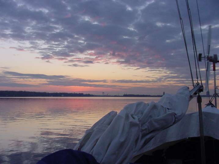
out Atchafalaya Bay for a 150-mile offshore passage. This time, although there
was light rain and strong current
coming in off the Gulf, the bulk of the trip was spent behind a full spinnaker
pulling us at 6 to 7 knots across a placid Gulf. Even the orange glows of the
refineries’ flares were beautifully visible 20 miles away throughout the night.
After staying overnight in Cameron, LA, we continued up the
Calcasieu River to Lake Charles, LA.
Although it was a navigational challenge to actually enter the lake, it turned
out to be as nice a place to
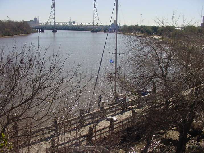
stay as Mandeville, LA. We really enjoyed Lake
Charles and it’s beautiful waterfront bike path, stores, laundromat,
libraries, parks and friendly locals. Mapleleaf Bruce Graham, the commanding
officer at the USCG station there even stopped by and admired Windigo one day.
When he spoke of he & his wife spending a few years right after retirement
doing what we do, I encouraged him, as I have many others since moving aboard.
It appears that we may meet up with several of the more adventurous among those
we have encountered in the years to come.
After a very relaxing few days, we left Lake Charles one very foggy morning,
visibility measured in yards. Heard news of the Shuttle Columbia on the VHF
radio in the form of a Coast Guard Pan-Pan (emergency) message alerting all
vessels in the area to be on the lookout for debris. It was not until much
later in Corpus Christi did we realize how close we were to the extended crash
site. A somber reminder of the crash sites I was assigned to while serving in
the USAF.
Sailing on, and crossing the Sabine
River put us into the very eastern edge of Texas, with Orange
being the first stop in that state. We visited the Wal-Mart to contribute to
the local economy, and got an extended bike ride in. The bike ride was bigger.
The Wal-Mart was bigger. By golly, everything was bigger in Texas.
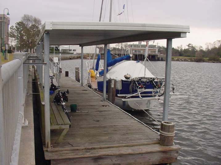
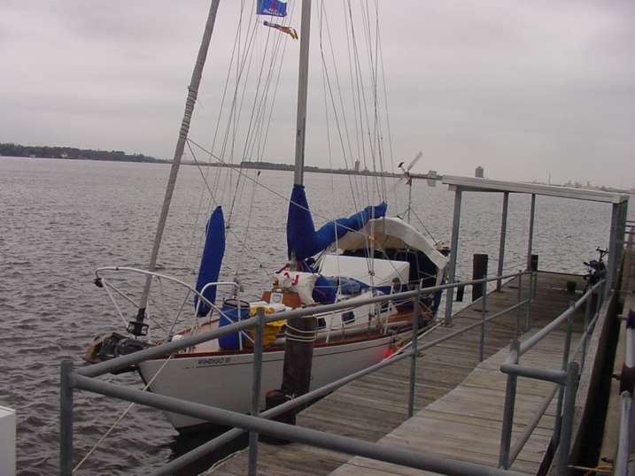
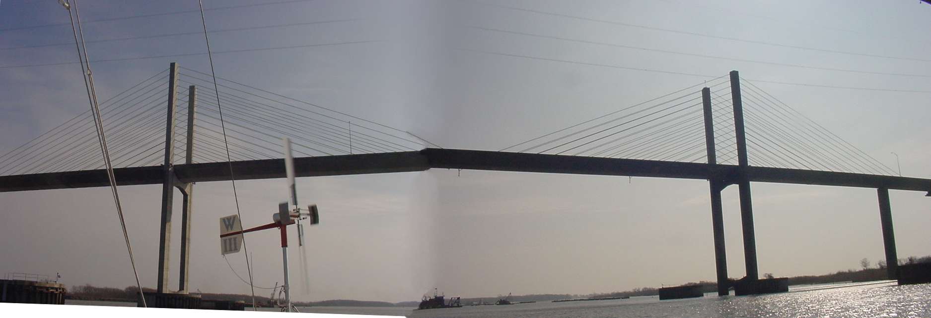
On to Beaumont, TX where
we experienced a high engine temperature alarm as we approached the railroad
bridge. Turned out to be a failed hose clamp resulting in coolant loss. [Little
did we realize this was the beginning of a series of tests coming for us] We
found an excellent city dock and took
advantage of wonderful weather to finish several boat projects. The library was
close, and we found good use of our time here - much activity ensued the three
days we stayed there.
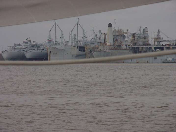
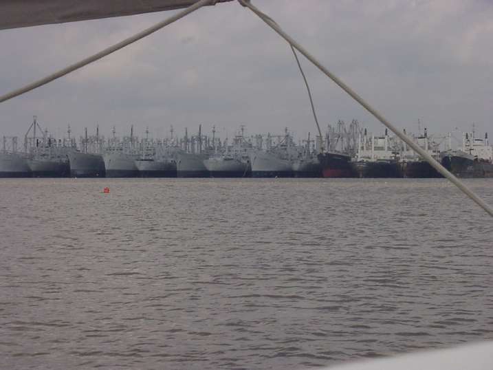
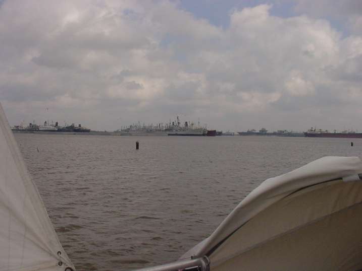
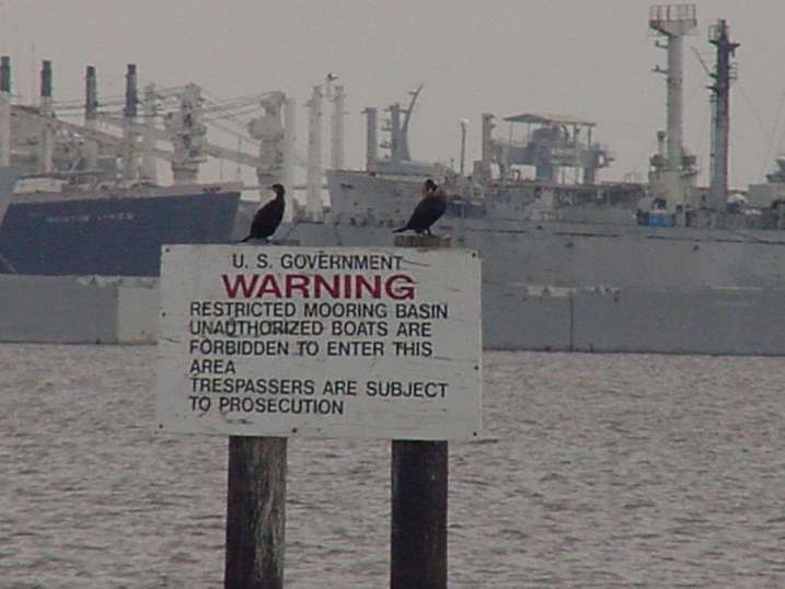
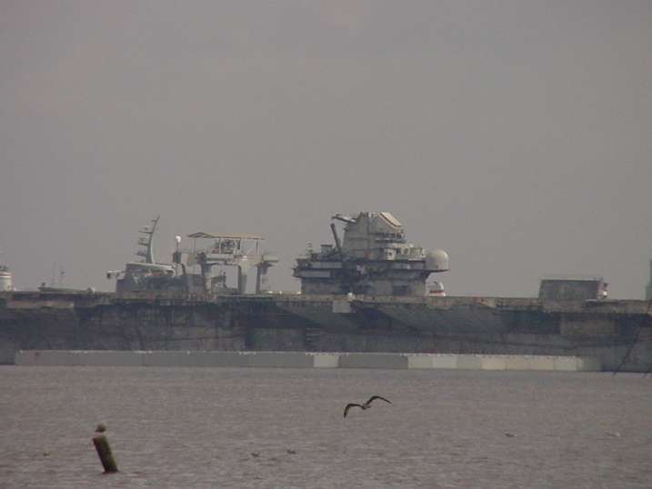
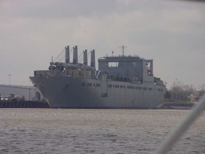
The pending Iraqi War was most apparent here as it is a
major deployment point for forces and equipment. They are pulling ships out of the dozens of rows available at the nearby navel basin on the Calcasieu River and bringing them to Beaumont to load with hundreds of every
type of earth-moving machinery and semi-tractors to haul them. We saw graders,
dozers, backhoes, front-end loaders, generator trucks, flatbed trucks, troop
carriers, and on & on. Several 100- to 150-car trains arrived each day to
be unloaded onto whatever ship was not full yet. The Cape Washington and Star Hosanger were there
for our stay. A grim reassurance that we ARE going to be involved in a war
soon.
From this point forward along the TX coast, I had marked
possible anchorages every 30 miles or so. But without any type of cruising
guide, these were only based on small irregularities in the coastline of the
chart and little population centers along the way. With a late start from
Beaumont, the very first opportunity to stop was an abandoned remains of a dock
near High Island, TX -- 50 nautical miles for the day. It was an ‘uphill’
struggle against strong current, and we reached it exhausted at 8:30pm.
With an early start, we continued down the IntraCostal Waterway heading for Houston
after a planned intermediate stop. But studying weather indications, it
appeared that a strong northerly was making itself known a couple days early.
The trip through Galveston Bay to Houston was generally north, with lots of
water on both sides of the channel. Being tired from the long previous day, and
just using what common sense we found lying around, we decided to pass smoothly
by Galveston and Houston. It did not go so smoothly.
By the time we reached the entrance to Galveston Bay, the
weather had turned a bit foul, blowing 25 to 30 knots out of the Northwest with
rain & fog. Crossing the opening for Galveston Bay is pretty open to the
NW, so the weather was very apparent. Although only large commercial vessels
are required to use the Vessel Traffic Services (VTS) by radioing the Coast
Guard on channel 12, I decided it would be wise to check in and notify the
controller of our presence and intentions. After identifying Windigo, he
instructed me to continue on and just let him know when we were clear of
crossing the Ship Channel.
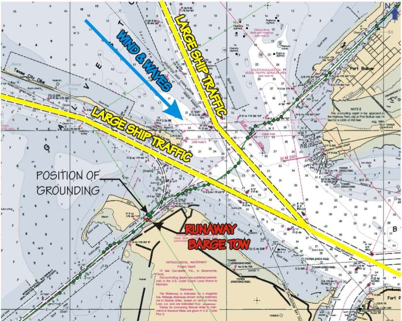
Now with the weather deteriorating, many of the larger
barge tows had decided to tie up to mooring cells along the ICW and wait for
better conditions. The Ship Channel crossing the ICW at the entrance of the Bay
was very busy with even larger ocean freighters in any case. With large vessel
traffic in both directions on two separate channels, we negotiated a bit of a
squirrelly course to make evident our intention of NOT getting in anyone’s way!
The worst of the weather occurred at this time, and this was a very memorable 2
miles of our journey.
But hey, with a bit of effort, we managed to work our way
across and just as I was reaching for the radio to call the man on ch.12 to let
him know we were outta there, Karin, who is piloting, says there is a barge
blocking the IntraCostal Waterway. I ask, “is it THAT wide?” She says, “No, it
is SIDEWAYS!” Well, although it was nearly ashore on the port side, there was a
40’-50’ gap on the starboard side between the barges and one of the very few
navigational markers within 100 miles. “Go ahead”, the captain says, and we promptly run aground. It seems that the
navigational marker was NOT to be trusted.
OK, so with 28 knots of wind and 3-foot waves, we should be
able to tip the keel up and push right off, sliding right between two mooring
cells 15 yards to leeward. But wait! The out-of-control-sideways-in-the-ICW
barge has ‘tugged’ itself off the lee shore, and is turning to tie to the ALL
the mooring cells next to us – blocking our escape. Down came the sails in a
hurry!
I thought this was a good time to actually use the radio
yet clutched firmly in my hand “. . . Yes, we are aground . . . No, there is no
environmental damage, and no one is injured . . . But the situation is NOT
stable, and no, there seems to be no indication of assistance from the nearby
barges” [not that I had much hope in their abilities, anyway!] I even gave the
word to send assistance. The dynamics of the day would not allow that, heavens
no! We start nudging toward the barge & mooring cells even with the sails
down.
With Karin at the wheel, and me manning the fenderboard (it
was too rough to leave it just tied to the beam of the boat) we slide off of
the shallows and aim for the mooring cell. Using the fenderboard, we roll
around the mooring cell until aimed in the proper direction [AWAY from the
barge] and tell Karin to “GIVE ‘ER”. With all the might Windigo’s little engine
could muster (I believe Windigo had an adrenaline rush comparable to ours) we
came about and passed around the stern of the tug.
In a very calm voice (yeah, right) I inform the man on
Channel 12 that all was once again right with the Sailing Vessel Windigo III.
He said “Thank you for checking in and have a nice voyage.” Oh, brother.
It was 8:30pm once again when we “found” a place to anchor for the
night. It was actually just a shallow spot along the ICW just short of
Freeport, TX, but we were pooped. The next morning we sailed through town and
anchored up the Brazos River. An uneventful day down to Matagorda Harbor led us
to believe that we had been through the worst. They wanted $20 to stay in the
Harbor, but it was actually still daylight, and the Harbormaster told us of a
nice anchorage in a little by-pass next to the lock at the edge of town. We
continue down, being delayed some time by the cable TV guys running a cable
over the pontoon swing bridge just before the lock. Finally, they get it clear,
and we anchor in the little by-pass. And it was still daylight! Man, our luck
has come right around . . .
It turns out the little by-pass runs straight to the Gulf,
and carries quite a current; which changes a couple times a day. Hardly
noticeable, except if you happen to look at the anchor trip line, which by
8:30pm had completely fouled in the rudder. So I set the second bow anchor to
be safe, and we go to bed.
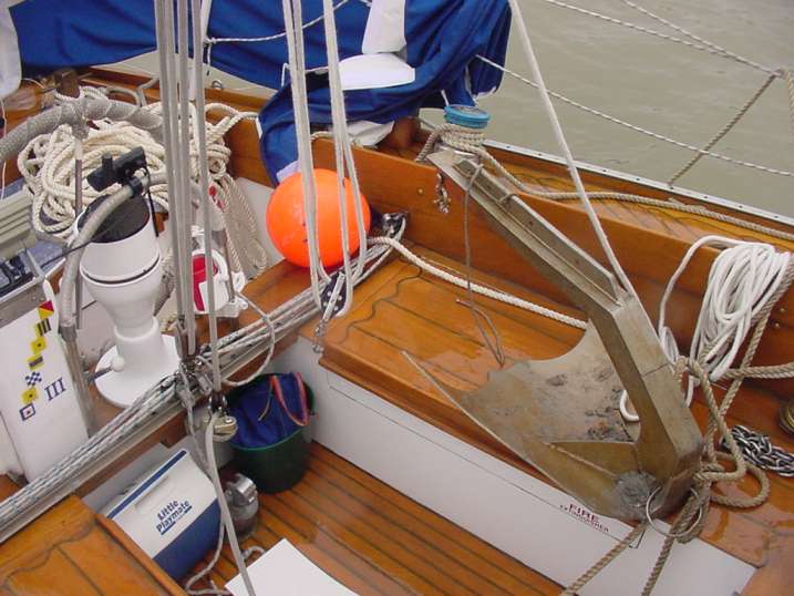
I plan on taking a little more time hauling up the two
anchors in the morning. But soon realize that time is not all we are going to
need. We did get the our mighty 70 pound stainless steel anchor up, with
the help of a knife to cut the trip line float, an anchor sentinel, another
length of chain, 400’ of line and a block & tackle on the end of the boom,
but the trip line was still firmly caught in the rudder, and maybe even the
prop. Rats. Set a third anchor for safety, and start rearranging to try to free
it.
Getting
the end of the trip line (cut from the anchor) worked into various positions,
it was apparently not going to come free easily. With the chances of it being
in the prop, we could not just yank it out with brute force. Somebody needed to
go down and assess the knotty situation.
Karin
volunteered. No, really, she did.
With the
water temperature at 9°C. [48°F.] and the air temperature 7.6°C. [45°F.] and
three knots of current coming in from the Gulf, I checked the exposure chart
and would not allow her more than 15 minutes in the water. With two lines on
the boat and me holding a third tether, she managed to get in, cut a bit of the
gnarly mess away, and more importantly, assure the prop was clear of any
entanglement.
After getting her back into the warm cabin, I winched the
rope and twisted the rudder until the line came free. A simple four-hour
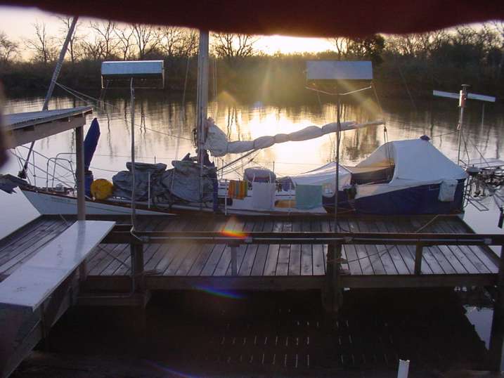
procedure that left us even more exhausted. We moved the boat through the
locks, around the corner and four miles up the Colorado River and tied to a
dock at a vacant fishcamp at 1pm. Believe it or not, the sun appeared, it
warmed up to a balmy 15°C., and we cleaned up and took a nap. Marvelous.
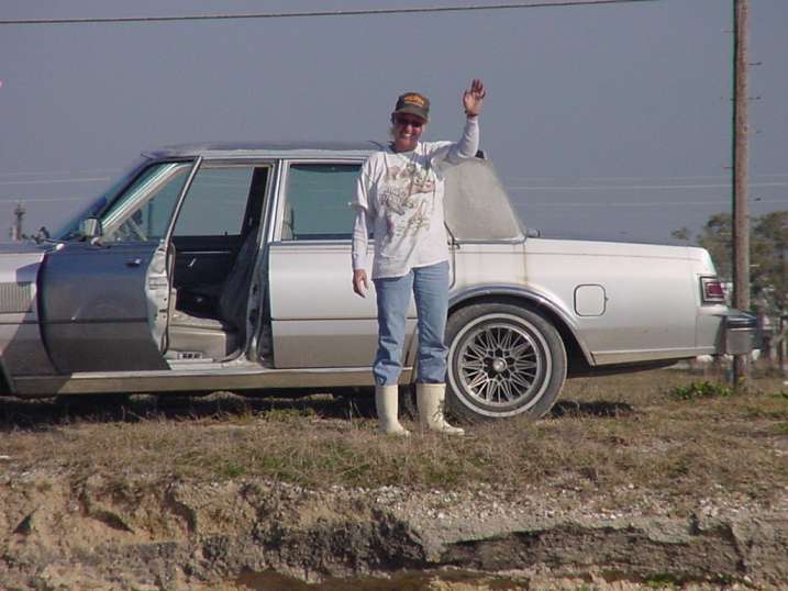
The next day, we had an easy 35-mile sail to Port O’Connor, TX. We began to walk the
two-and-a-half miles to the laundromat (the “dock” we chose made it impossible
to get our bikes ashore because we had to scale a wall) and a friendly local
stopped and gave us a ride. When the clothes were finished, we began the return
walk, when Suzie pulled up beside us once again
and said, “I thought y’all would be finished ‘bout now” and drove us not only
back to the boat, but around the town for a tour. Suzie is a shrimp boat
captain, and she invited us to go “oystering” the next day. We accepted, but
alas, her crew was not as dependable as we, so the outing was cancelled.
Feeling badly, she phoned her friend in Corpus Christi and made arrangements
for us to ride in his shrimp boat when we got there if we wished.
Our stay in Aransas Pass, TX
was an uneventful evening in the City’s Conn Brown Harbor with dozens of shrimp
boats all around. We left early the next morning, relocating for our eighth day
in a row. But this day we were embarking on the very last leg of this portion
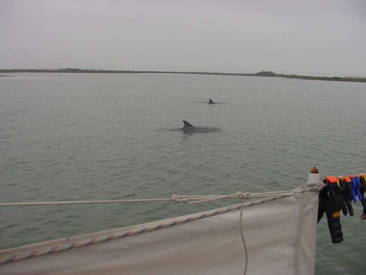
of our journey, for the destination was Corpus Christi, TX. Just as they have
done several other days, the dolphins
followed us for quite a while as we sailed along the ICW. Pacing us, and
occasionally darting and crossing at the bow, a pod of a couple dozen played
and showed off for the crew of Windigo III.
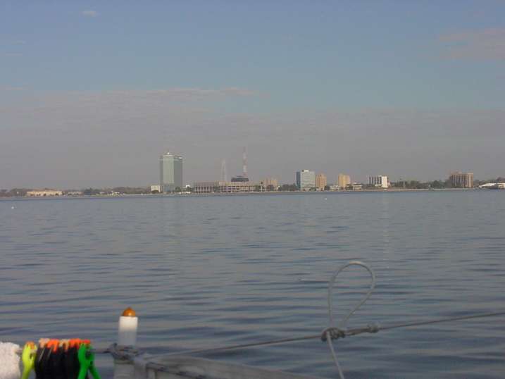
Just to make sure we were paying attention, the weather
once again became thick with fog. But it was a short 25 miles to travel, and
Corpus Christi Bay is deep enough for us to slip out of the main channel and
sail around the beachfront and into the harbor where we have been for the last
few weeks.
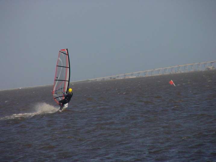
My Mom visited us here, staying with her good friends the
Schuler’s. The Schuler’s have also been our best friends, taking us shopping
[big restocking trip to Sam’s Club] and to church, feeding us frequently [Karl
is quite the shrimpboil chef] and even exposing us to the terrific windsurfing that is very popular in this
windy area of large, shallow bodies of water.
We have finished every single boat project we can think of.
So now it appears we are ready for “The Crossing”. All we are awaiting is the
arrival of The Good Doctor.
Our permanent and EXACT address:
Capt. KL & Karin Hughes
S/V WindigoIII • PMB 365
88005 Overseas Hwy. #9
Islamorada, FL
36033-3087
Text-only Email addresses aboard Windigo, checked daily:
Email addresses checked when at a computer
And of course, the Windigo Travelogue Catalogue: