31 OCT – 4 NOV 2001
The
Tennessee-Tombigbee Waterway (Tenn-Tom) Divide Section
I’ve enjoyed
explaining the origins, history, and present use of the waterway we’ve traveled
so far, but to describe the Tenn-Tom Waterway, well . . . it would take
volumes. Lots of interesting facts, photos, and details of operation of this
relatively newcomer to the world of navigation can be found at the following
sites:
www.mvr.usace.army.mil/navdata/Default.htm
www.sam.usace.army.mil/op/nav/
www.sam.usace.army.mil/op/rec/tenn-tom
While
I’m doling out websites, here’s some more in-depth info I used to investigate
& plan our waterway journey:
www.mvr.usace.army.mil/navdata/ilchart.htm
(There
are other sources to obtain all the charts we needed from the internet; and now
the Army Corps of Engineers {ACE} has made available the interactive electronic
charts of the Tenn-Tom waterway – you just send them a blank CD-ROM and they
fill it for you!)
If
you wanna read this letter before you get a couple hours to research the sites
above, let me just say that the Tenn-Tom is unique in the world. It is a
man-made connection of 16,000 miles of inland rivers directly with the Gulf of
Mexico’s Intercoastal Waterway. Its construction has been traveled, surveyed,
planned and debated for over 400 years (DeSoto used this basic route to get
from Florida to the Mississippi). It was completed in 1985 – it is only 15
years old! It is the single largest construction project in the world, well
over ten times the size of the Panama Canal (& visible from outer space
with the naked eye).
It
is composed of three sections, each different in their design and construction.
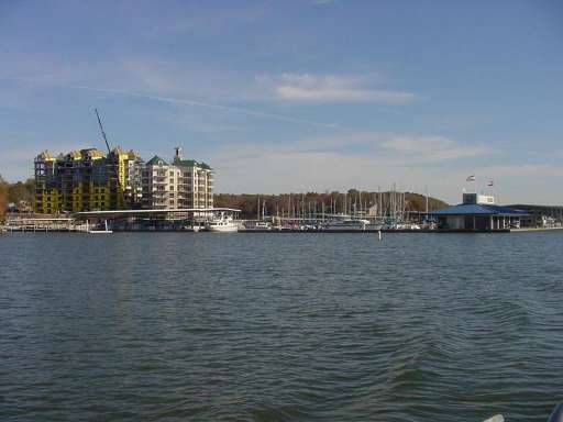
The most northern section (this letter) runs south from the junction of the
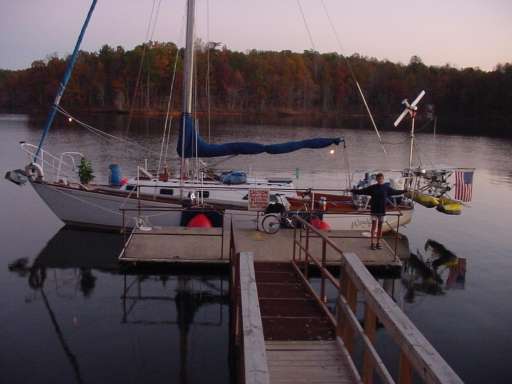
Tennessee River & Yellow Creek (Pickwick+Tenn-Tom
marina in Yellow Creek.jpg) to Bay Springs Lake formed by the
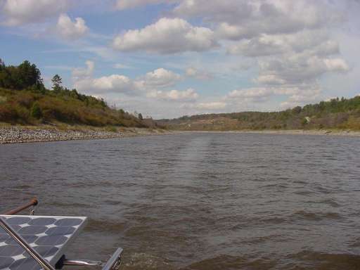
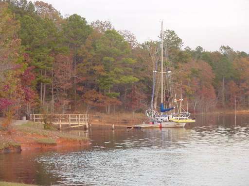
Jamie Whitten lock & dam. It starts out following the course of the old
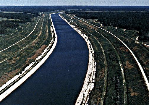
Yellow Creek, Town Creek, and other little streams (Tenn-Tom divide section.jpg). Then the
ACE cut a 39-mile path across a sub-continental divide between the Tennessee
& Tombigbee Rivers. Very impressive! (Divide Cut,
Tennessee-Tombigbee Waterway.jpg)
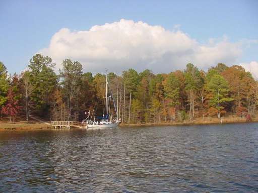
There
are no locks on this section, and no ports or parks until Bay Springs Lake. The
sightseeing consists of marveling at the actual waterway construction itself.
it seems that only a 600’ wide path of the forest was disturbed to create this
channel (deer crossing.MPG). During the
entire 234-mile Tenn-Tom project, 255 homes were displaced – not that many
considering the ten locks & five dams created ten lakes, five of which are
about 7000 to 8000 acres each! Actually, most of the families moved were from
Holcut, MS, the only entire town taken over by the project. This town had lain
directly in the course of the divide section.
Staying
on Bay Springs Lake was exceptional – we were there for 5 days (cotton springs dock.JPG), so far we only stayed longer
in Nashville & Chicago. We had our own private [free] dock (sunset @ cotton springs.jpg) with a
sidewalk to the restrooms (dock @ cotton
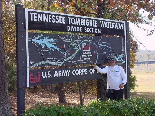
springs.jpg). We were surrounded by hundreds of acres of federal
parkland and walking distance to the lock & dam and a visitor center (KL divide section sign.jpg). [This
arrangement was found at most of our stops along the Tenn-Tom in Mississippi.]
Security
at the lock facilities have varied greatly, the last one at Pickwick was THE
most secure facility on the river. Federal police officers guarded the road
that led to the driveway of the visitor center 24 hours a day. I stopped to
take a picture of the lock (the whirlpool one) from a bridge near the lock –
the lockmaster sent the police to find me and take my ID information! We tried
to get a friend of a friend who knew the head of the security station there to
let us see the visitor center, but "Tommy" said "no way uh-uh
sorry Ted, but my orders came straight from Ashcroft and I can’t exercise any
discretion"!
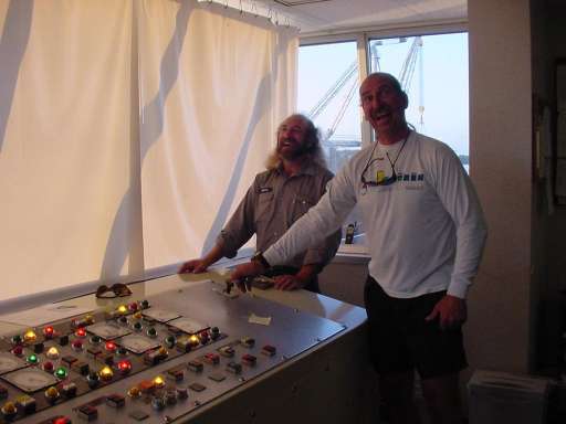
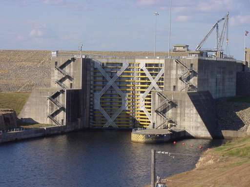
Now
at Jamie Whitten, it seems the ACE have things under control. Not only did we
get into the actual lock operation center; I had a chance to run the lock
doors! (KL opens lock doors.jpg) And this is
the third largest lock in the US! (109' lock
doors.jpg)
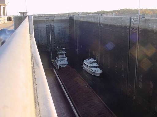
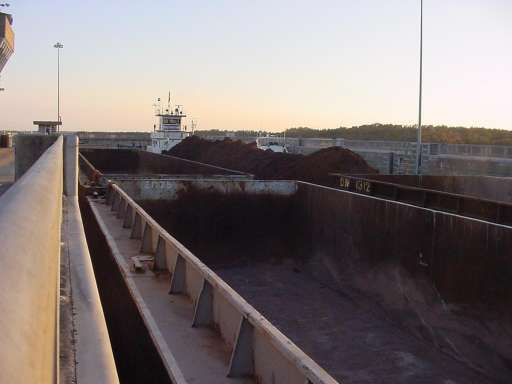
I’ve
included lots of pix of this impressive structure (bargetow & boat DOWN.jpg & bargetow & boat UP.jpg & doors close from wall.MPG) [it takes
46 million gallons of water to fill it in 13 minutes using NO pumps]. We even
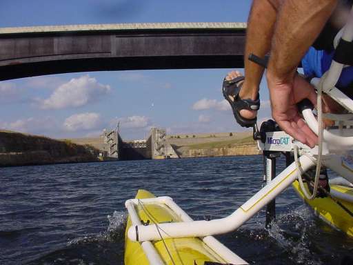
locked through riding Pedigo (Pedigo
approaching lock.JPG).
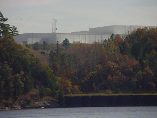
Oh
yeah, the NASA building picture (secret NASA
building.jpg). I saw this building from the Yellow Creek as we were
floating by, right next to a HUGE concrete dock in the middle of nowhere. On
the chart it identifies the landowner as "NASA". I happened to
mention it to a ranger at the Bay Springs Visitor Center and he said, . . .
"that place was built over a dozen years ago. Now they don’t use it for
anything." I asked how he knew that, he just smiled and said, "a
friend I went to high school with has worked there for years, and HE SAYS that
they don’t use it."
??????????
I
asked what his friend does, and he told me he was a rocket scientist, and that
he could verify " ‘cause when all them guys that work there [at the plant
NASA is NOT using] are at a party, nobody else can figure out what the heck
they are talkin’ ‘bout."
The
lock operator later told about this huge rocket thing he locked through a
couple weeks ago on its way to Florida. He said it was impressive because it
wasn’t on a barge, it was on an actual ocean freighter [marked ‘NASA’] that
barely fit in the lock. He wanted a peek at the rocket, but it was all tarped
over.
Fun
& spying on the Tenn-Tom!
Kevin &
Karin Hughes
S/V WindigoIII
"We’re
in warm weather & we’re goin’ slowly"