Hi All~
This Eletter with
all the links to amazing never-before-seen photos is at:
http://www.ciekurzis.org/The
Bimini Islands/The Bimini Islands.htm
The Bahamas 101 – The Bimini
Islands
I have heard that
every one of the 750 Bahamian Islands has a different
character. The Islanders are all said to be friendly [so far that’s
verified] but the differences can be vast concerning how each place “tastes”. I
will endeavor to describe the flavor of the
Bimini Islands, especially North Bimini, where we spent wo weeks.
I am also on a
mission to find a place to have my grandchildren come and visit [with their Mom
& Dad] somewhere in the Bahamas. Jessy, here’s a preview of what I can afford on Bimini.
Everyone In Bimini Wants
To Be Like An American.
Being only 42
miles from Miami, one of the largest cultural centers in America, the Biminites
are exposed to the best and worst of America. Many of them have spent extensive
time in America and some have stayed, leaving relatives in both places.
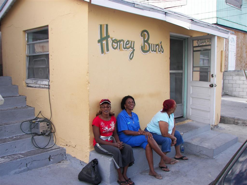
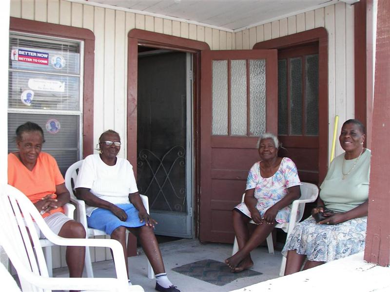
Speaking of
families, I will mention now that the 1000 residents of North Bimini generally
fall into three families: the Saunders, the Browns and the Rolles (pronounced
“Roll”). These families have intermarried, but the patriarchal roots are well
know. More on these peoples later.
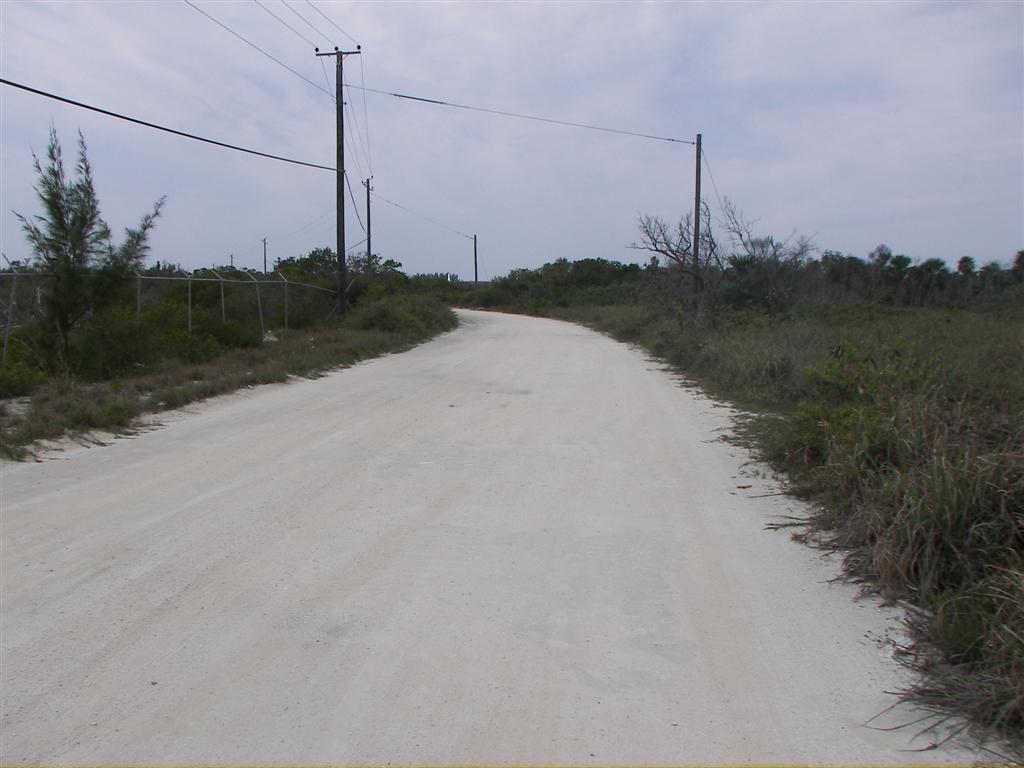
The first obvious
sign that Biminites wanna be like Americans is that although they have
basically one road on the island [King’s Highway] and it is two miles long,
there are 200 cars trucks and buses on the island. (To be fair, that estimate
includes South Bimini, a tiny fraction of the population of North Bimini, they
have only a couple dozen vehicles as far as I counted.) some people have four
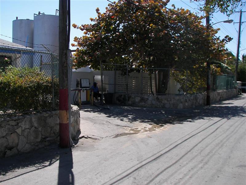
or FIVE cars! And they DRIVE them . . up & down . . up & down . . up
& down. Good thing there is fuel (a Gas
Station??) available on the “Highway”.
Next are cell phones: everyone has them.
Bahamas Telephone Company has a firm grip on the phone service here, so EVERY
phone is a Batelco phone, and costs 40˘ a
minute. Batelco also provides cable TV, which mostly consists of American TV
[Oprah].
In a place where you could walk a couple hundred yards
and holler to get the attention of any other resident, they have cars &
cell phones; Because Americans have cars & cell phones [& Oprah].
The Character Of The Land.
Bimini is not a wealthy island. The water
and electrical service to some structures consists of a garden hose and
extension cord (lying across King’s Highway!). Food is expensive – three times
the cost of food at a discount supermarket in Florida. Fuel is a third more
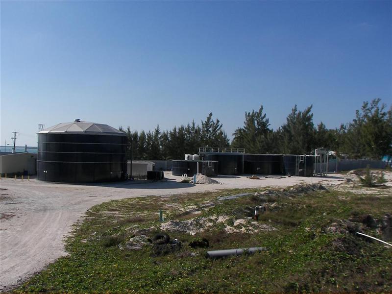
expensive. Water comes only from
a reverse osmosis plant, which is fairly costly, because most of the wells
(in ALL of the “developed” Bahamas) have become tainted with saltwater because
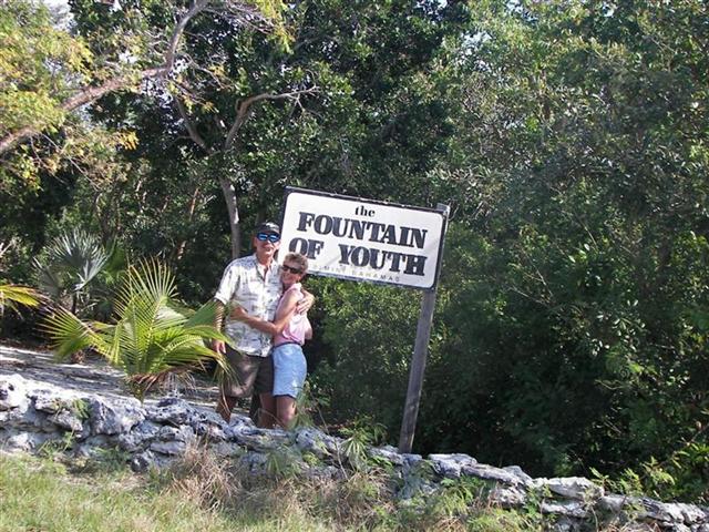
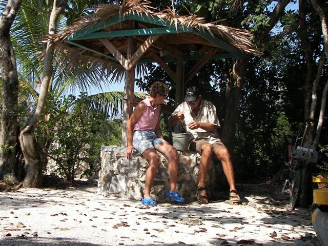
of overuse [more on this later]. (South Bimini is a site for one of the many “Fountain of Youth” wells Ponce DeLeon
sought in the 16th century. I’ve seen
four now. ;-] )
Jobs are not plentiful, but those willing
to work do, and many make a living “hustling”. In short, hustling is “providing
services for tourists” as tourism is just about the only industry in North
Bimini and any other “visitable” island in The Bahamas. These services could be
assisting a cruising sailor in finding the appropriate customs &
immigration offices, providing a guided tour, scoring some weed, arranging
transportation to ?????, etc. their slogan is, “Anything, anytime, anywhere.”
(for a buck). Actually a needed trade in a tourism-fueled economy.
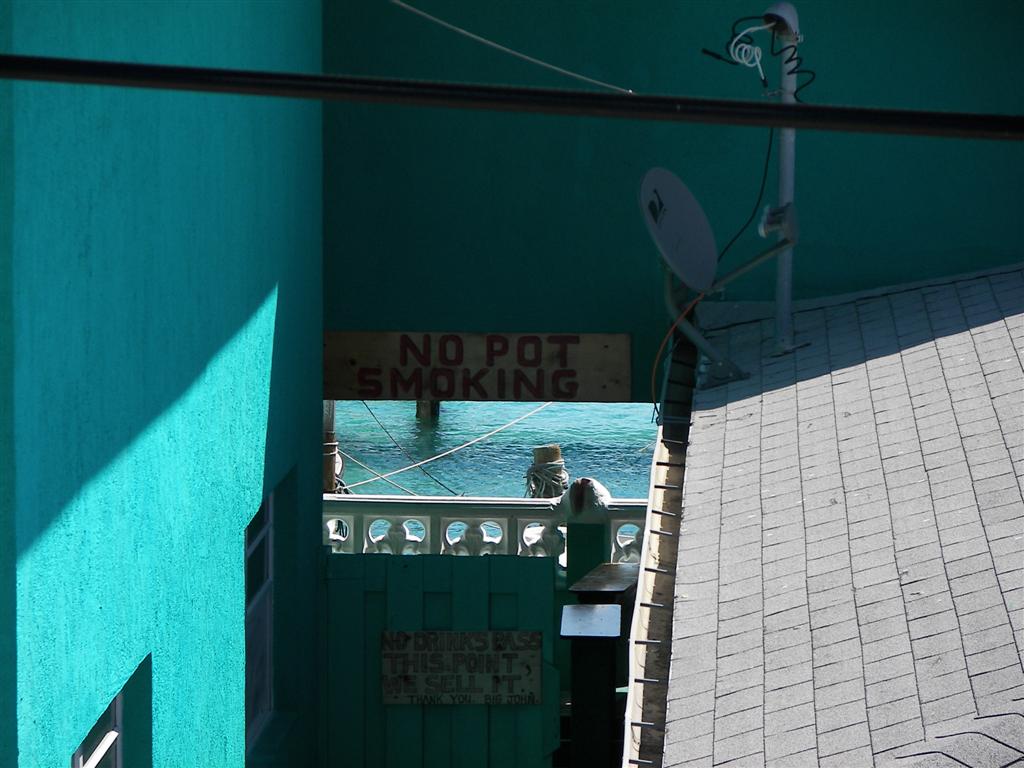
(Mentioned ‘weed’ above – the Bahamian
Government has an advertised strong stance against drug use, and on the islands
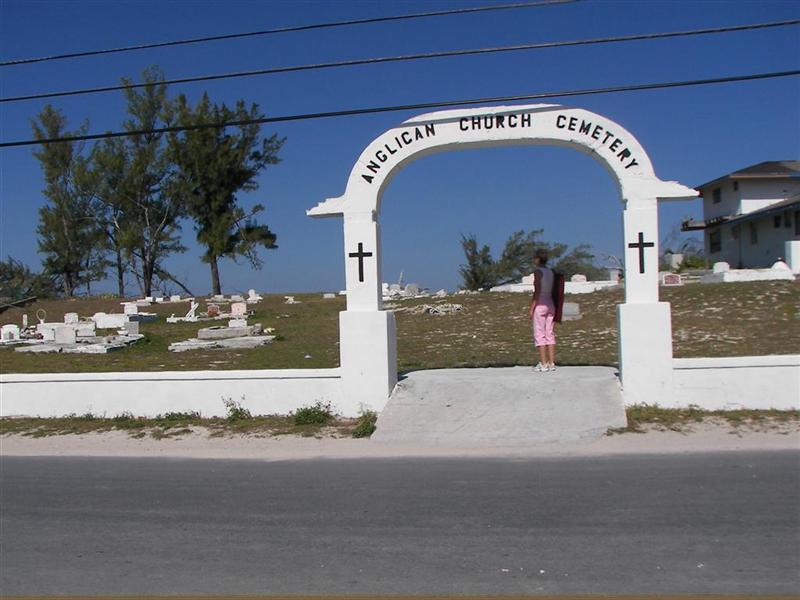
enforcement translates to this sign. On Sunday
morning, you will find every resident at one of the TEN churches on the
island, or on the beach getting high.) {We went to the Methodist service in
the oldest (150 years!) church building on the island.}
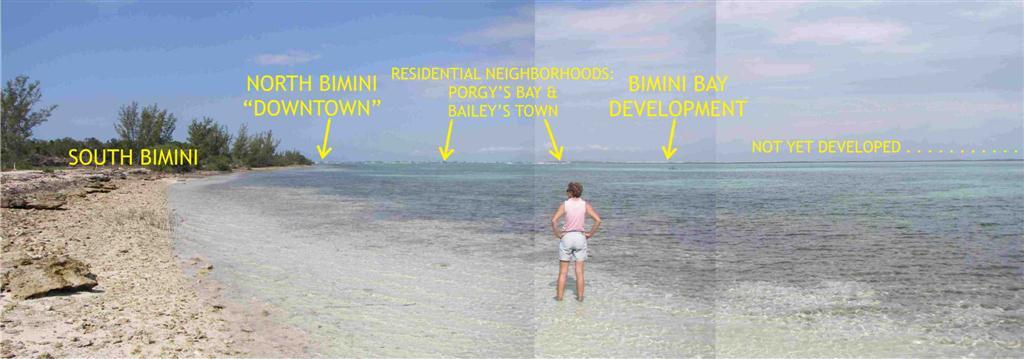
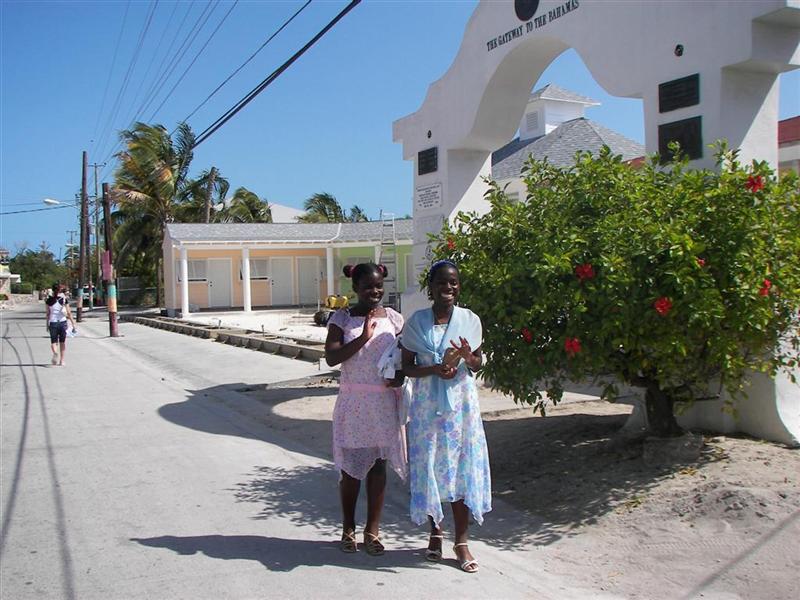
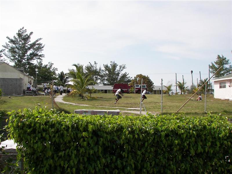
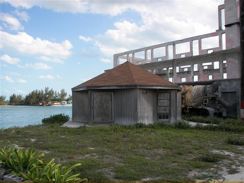
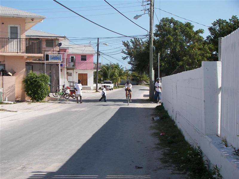
So the ‘downtown’ area is slightly
‘run-down’, but that’s the way they like it for the tourists. There are interesting touches here and there, and the ruins
of the Compleat Angler, the
hotel made famous by Ernest Hemingway. At night, the bars are HOPPING. There
are stores, restaurants,
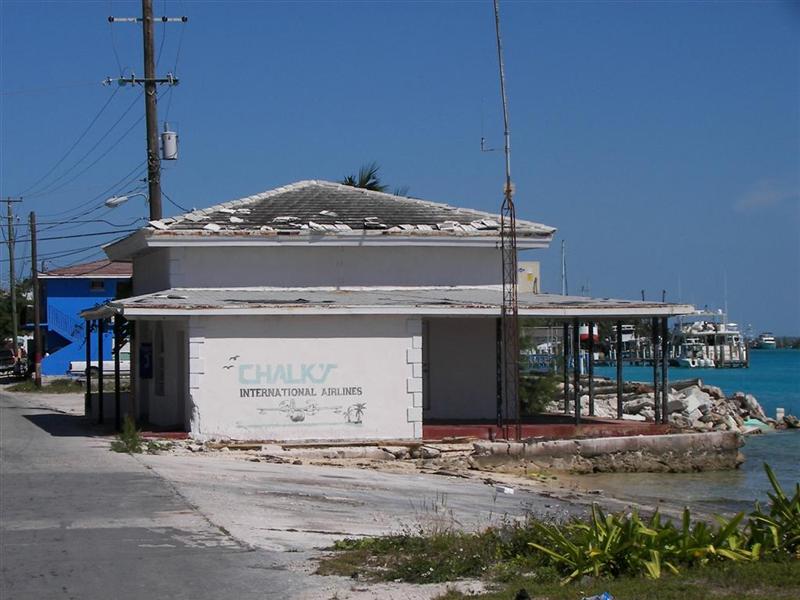
bus stops, travel agencies, political offices, and an INTERNATIONAL AIRPORT.
(Don’t be impressed – EVERY Bahamian island has an INTERNATIONAL AIRPORT!).
the%20Compleat%20Angler.jpg)
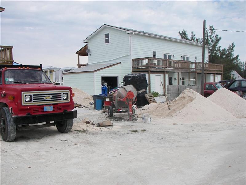
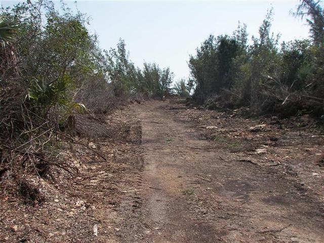
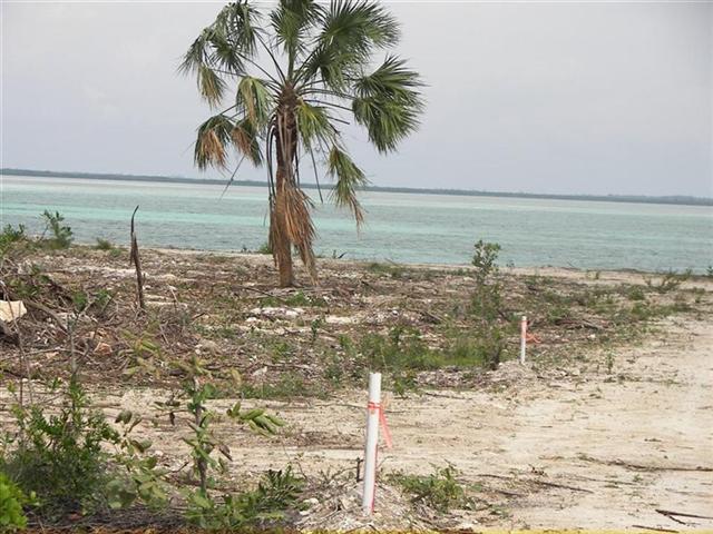
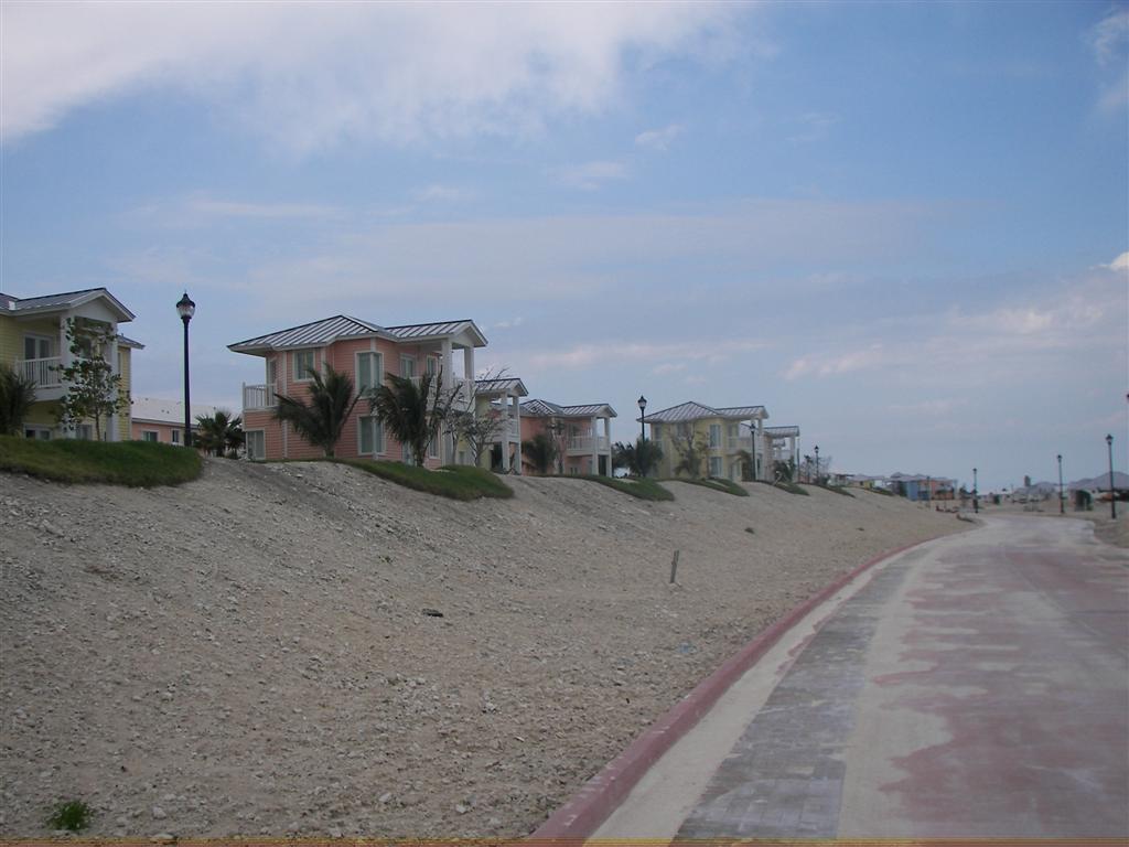
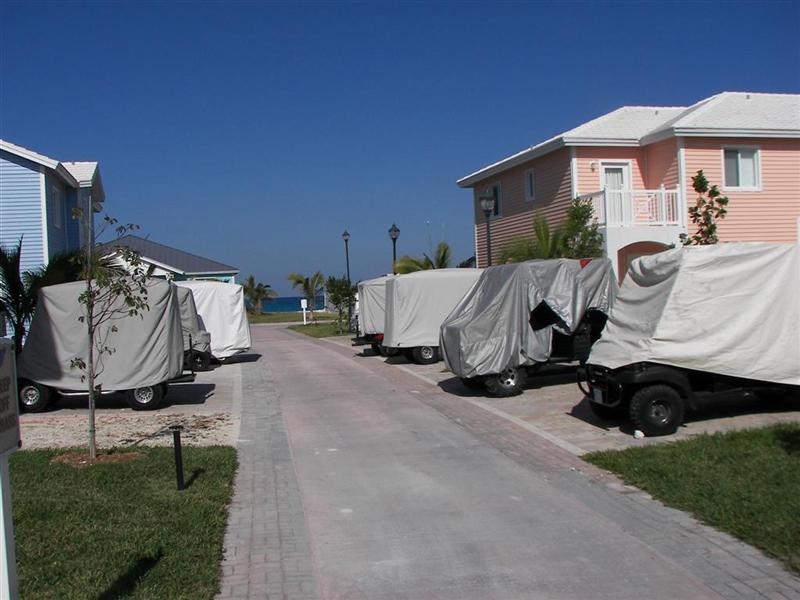
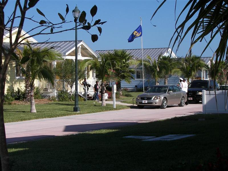
Before you feel sorry for the Biminites,
realize that although the appearance is impoverished, there are Biminites with
MONEY. You see, they have sold the north two-thirds of their island to a
Cuban-American. He is a VERY good businessman, which means he rotates out his
Cuban, then Haitian, then Mexican, then ??? workforce periodically to keep work
standards and wages low and the fresh workers continue to push the project to
completion. The “project” is to
transform a narrow strip of barren land and mangrove swamps into hundreds of
million-dollar concrete shacks and a thousand-slip marina. This will be
ongoing for decades to come, but the residents have recently seen hundreds of
acres of mangroves destroyed for this “development” and vow to not let any more
succumb to The Man (a Mr. Capo). Very different
from a “Bahamian construction site”.
construction.jpg)
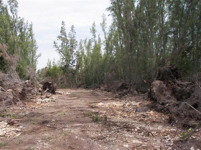
[The mangroves are the next-best-thing to a
freshwater estuary, and the only place in this part of the world where many,
many species procreate and live. To destroy the mangroves would interrupt the
food chain and collapse the ocean ecosystem. But The Man hasn’t figured that
out OR he doesn’t care.]
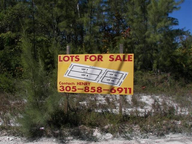
Many other Americans are involved in “real
estate” on Bimini and other Bahamian Islands.
Invariably, the phone number on the (Bahamas) FOR SALE signs is one in Miami or
Fort Lauderdale. Sad that the people here have lost a lot of control over
their country.
Progress on The Bahamas: #1 #2 #3 #4 #5
#6 #7 #8 #9 #10
.jpg)
The Man has worked his way into his
position by making promises. Many say he doesn’t keep them, but I saw proof
both ways. The several schools had only a barren field for outdoor sports and
nothing much for inside stuff. The Man is finishing a gymnasium at one of the
schools, but the outside athletic field is only
this far along after seven months of ‘work’. Excuses keep the children on a scrubby side of a hill
for outdoor sports.
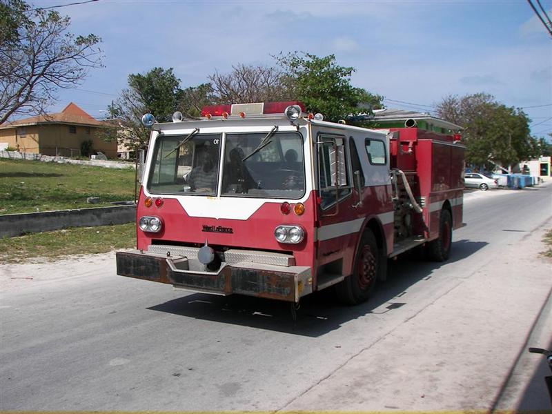
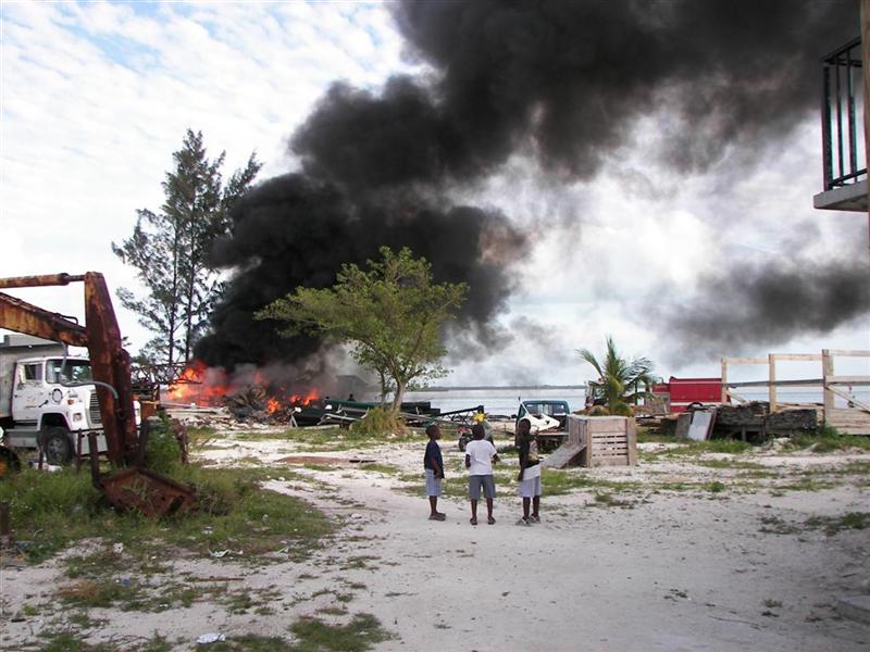
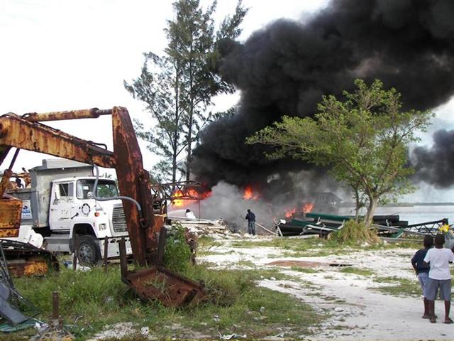
He also promised a new fire engine. This old, rusty truck isn’t even kept near downtown
by the aged wooden buildings, but up at the resort, to protect the million-dollar
concrete shacks(?). But it was
brought down one day to battle an out-of-control trash fire. They saved the pine trees.
While on Bimini, we met Patrick Prince (P.O.) Brown. P.O. is a former Nassau
gang-member who has returned to his hometown to turn his life around after some
jail time. He works construction (occasionally) but is a poet and musician at
heart. He has a rare personality mix of being VERY street-smart, and yet naďve
about the world outside his experiences. His poetry is mostly based on his
battling/exposing his past and injustices by The Man with a gospel-based
goodness that reads true. [My favorite concept is he believes in the ultimate
failure of the establishment – “Babylon” in street lingo.]
Karin
transcribed his music, and we were given permission to investigate a
commercial use for it. If anyone has an interest, please contact me. {The “studio” where P.O. makes his CDs}
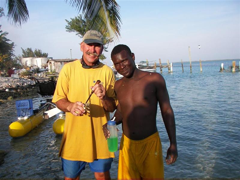
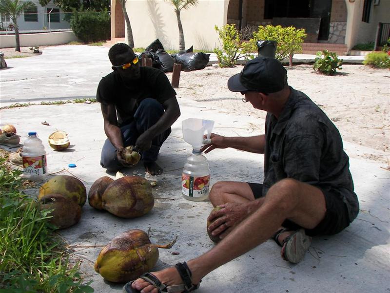
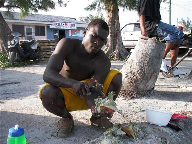
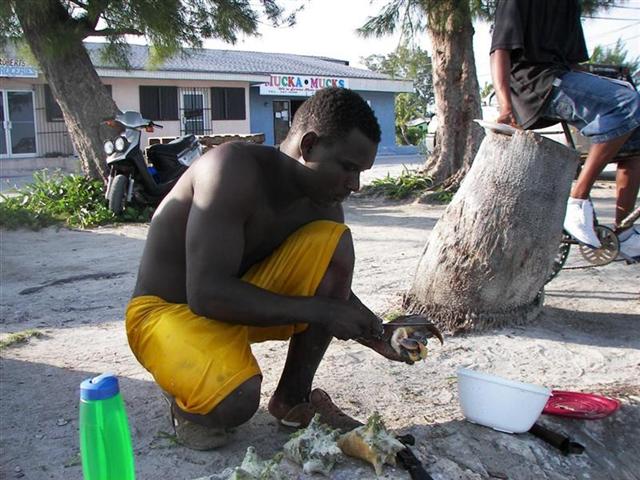
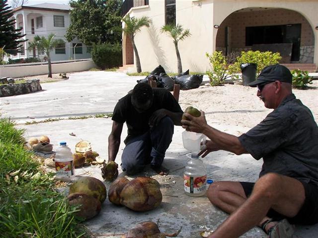
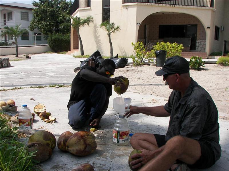
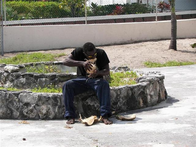
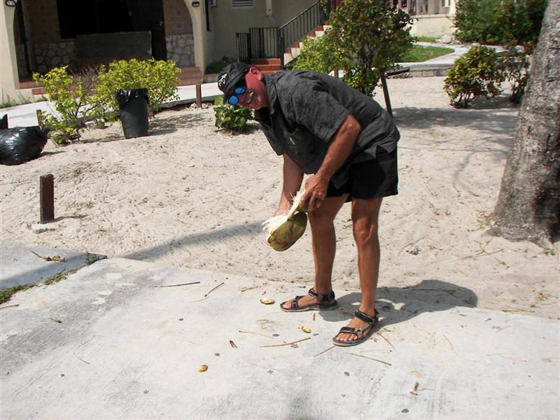
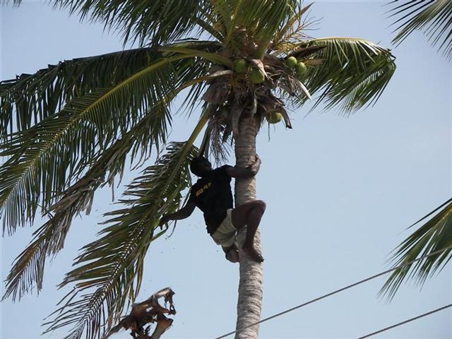
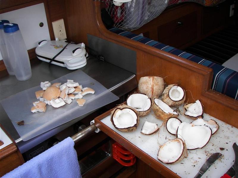
P.O. has a natural teaching skill,
and I hired him to teach me to retrieve
and clean conch and bark and juice coconuts. These tasks can be done
entirely by hand (or mouth!), as he taught me, or made a little easier with
simple tools. (A conch hammer was our only purchase on Bimini!) He is quite a
character, sometimes climbing the highest palms
in town just to clear away the dead branches
and spruce up the place.
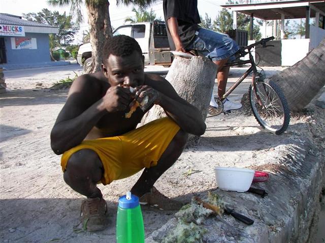
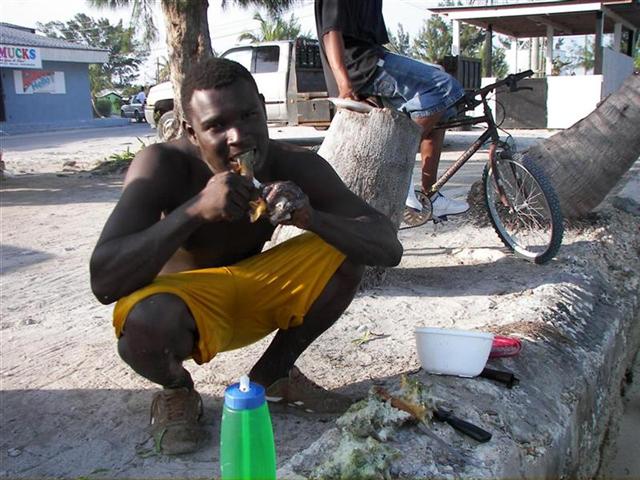
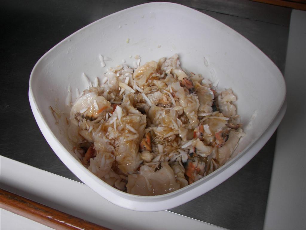
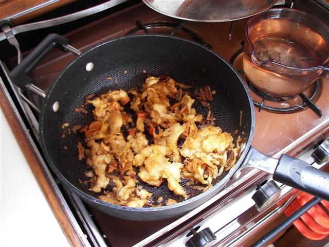
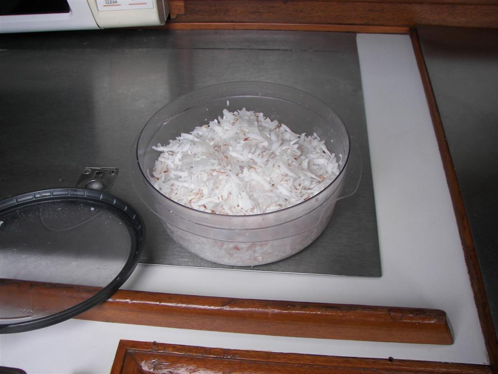
Now coconut
and conch have become our primary diet. Added to the canned victuals aboard Windigo, we make some gourmet treats impossible without the freshest ingredients.
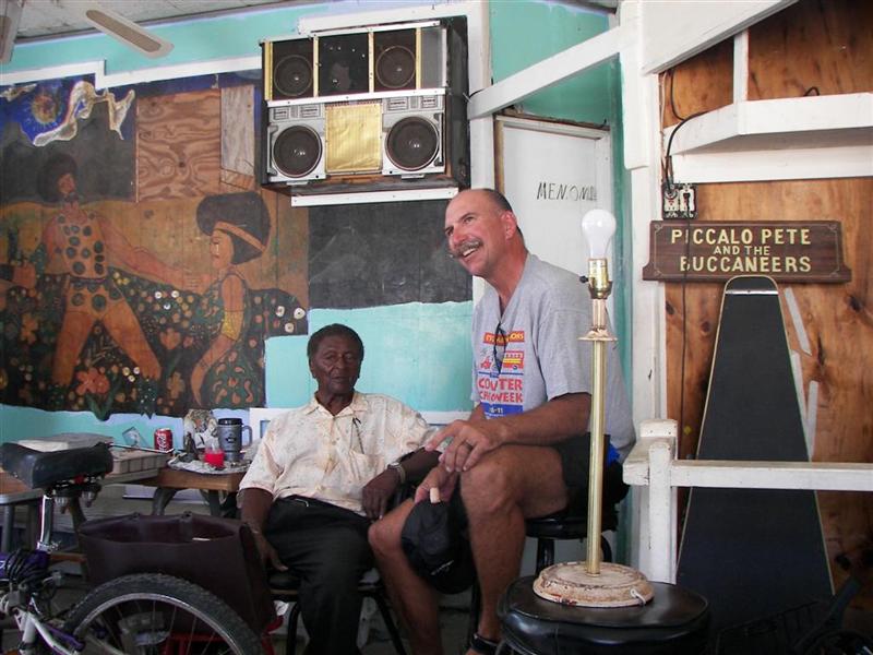
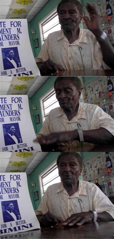
I also befriended Nathaniel Clement “Piccolo Pete” Saunders, the
oldest living resident of Bimini. At 94, he is the patriarch of the island,
and what a storied life! From having a white uncle and
a white adoptive father, to many years supervising on a plantation in the US,
military service, decades as an entertainer, and political service. His entire family was killed by a
hurricane when it destroyed their home on this location in 1926 when he was 14
years old. Although he resisted at first, the local constabulary ‘forced’
him to participate in rum-running during prohibition, and he made a bundle.
Now he repairs bicycles and gives them to
island children, hires a few unfortunates to do work around his “Club” [where
he now lives], and plays ‘Uncle’ and ‘Grandpa’ to the island residence. If your
watchband comes undone, Natty can make it done again! What a character.
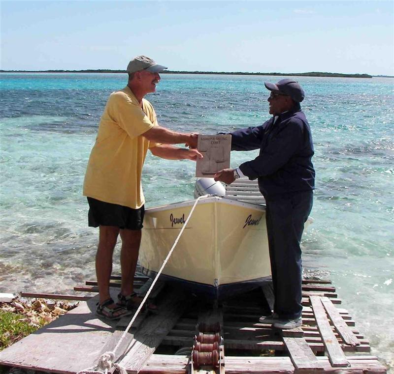
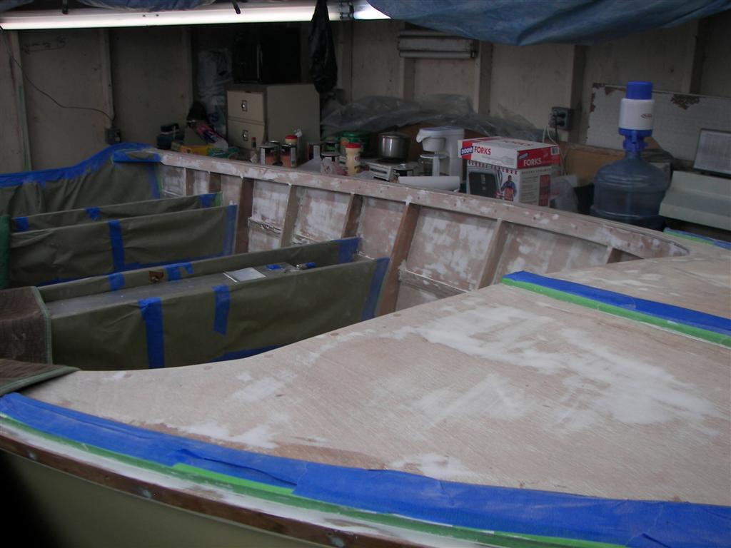
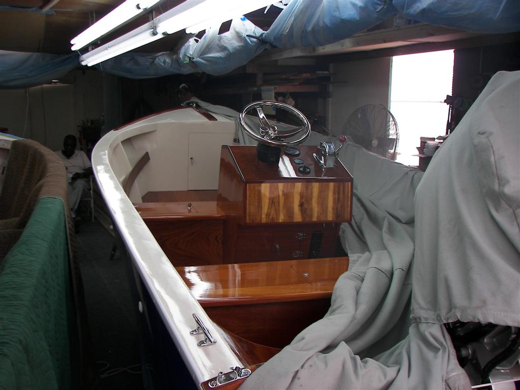
Ansil Saunders (nephew
to Natty, along with P.O., of course) has just about the only manufacturing
business on the island. A former political leader in “the Struggle” (for
independence in 1973, and after), Ansil
builds wooden “bonefish” boats of native woods. He is the last wooden
boatbuilder in all of The Bahamas and man, what beautiful boats he builds. His
brother Tommy lays 12 coats of varnish
and several of paint on the hulls to make these some of the best-built
vessel I have seen.
Randy Rolle has retired in his hometown on
Bimini Island after playing baseball for the Atlanta Braves.
Chiquita Rolle has just returned to Bimini
after running a service station in St. Petersburg for a year (a place where I
actually bought fuel! Small world. . .) is the ONLY person on the island
without a nickname – but she does call herself The “Black Banana”!
Wildlife.
I will now reveal my technique for finding
out so much is such a short period about this place. I do so as an introduction
to the dogs of Bimini. Confused? Read on:
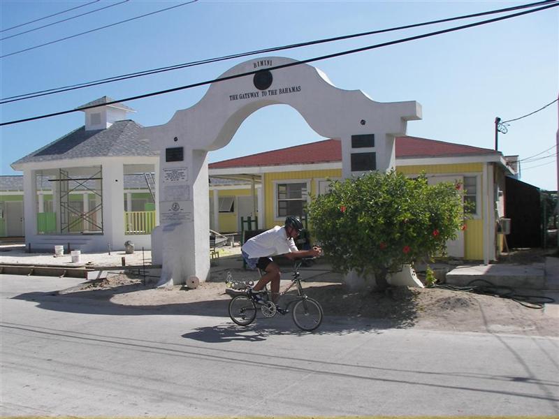
Very early in our visit, I rode a century on my bike. It was a
Sunday, and once back in a former life, a 100-mile ride was de rigeur on a
pleasant Sunday, so this didn’t seem to be that unusual; except remember the
King’s Highway is only about 2-miles long. That’s right, I made 22 trips up & down the island
on that Sunday. 44 times past every place in town. I met EVERYBODY, saw
EVERYTHING. It was grand, and now I intend to repeat this stunt at every applicable
island to warm up to the place.
There are many doggies on Bimini, just as
there is everywhere. Dogs are Man’s Best Friend, after all. But dogs HATE
cyclists! Funny thing is that even the dogs are laid back in The Bahamas. Not
once was I chased, molested, attacked, or snapped at. I was barked at once; I
think that was because I came around a corner (one of two “jogs” in the King’s
Highway) a little fast and startled the puppy – later on, we were the best of
buddies.
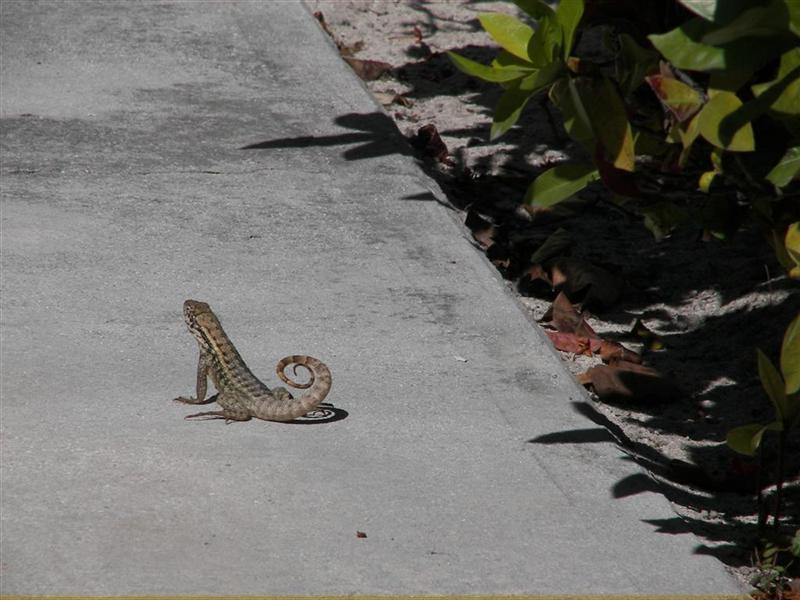
The lizards are twice as
big as Florida and Alabama lizards, and these curl their tails!
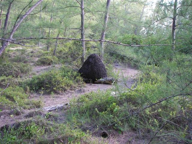
Giant
termite mounds abound in the remote areas.
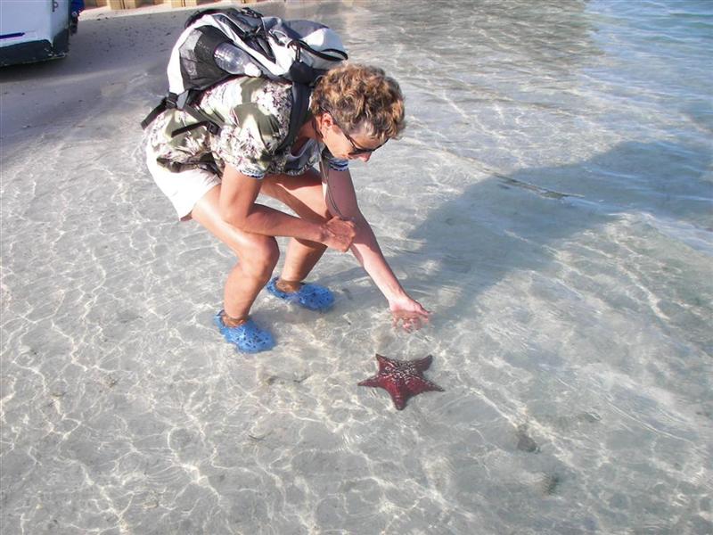
The
starfish are HUGE and colorful!
The bugs are taken care of by the constant
breezes. Nice!
Fish everywhere, conch in the shallows, and
the birds are tamer than in the US.
Oh yes, the
goats – in front of the meat market?
Hmmmm.
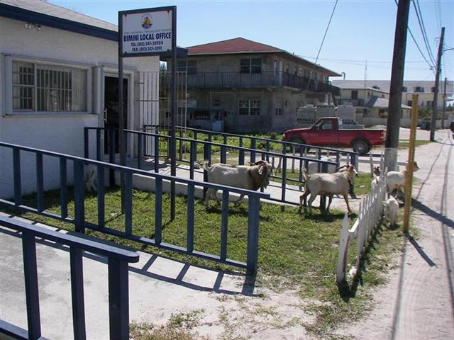
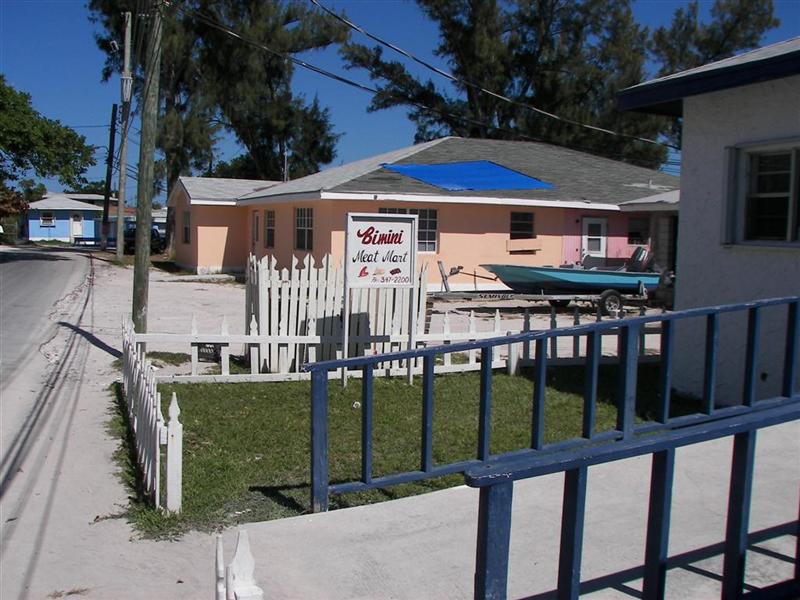
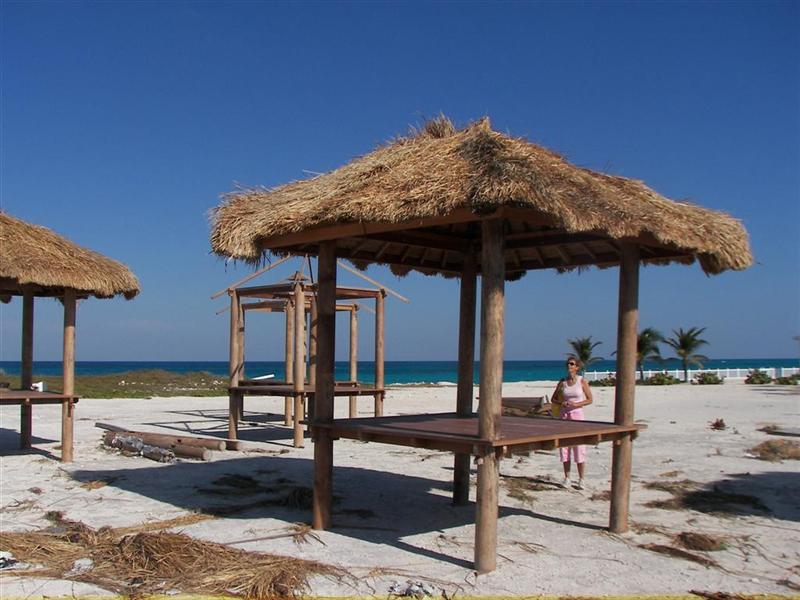
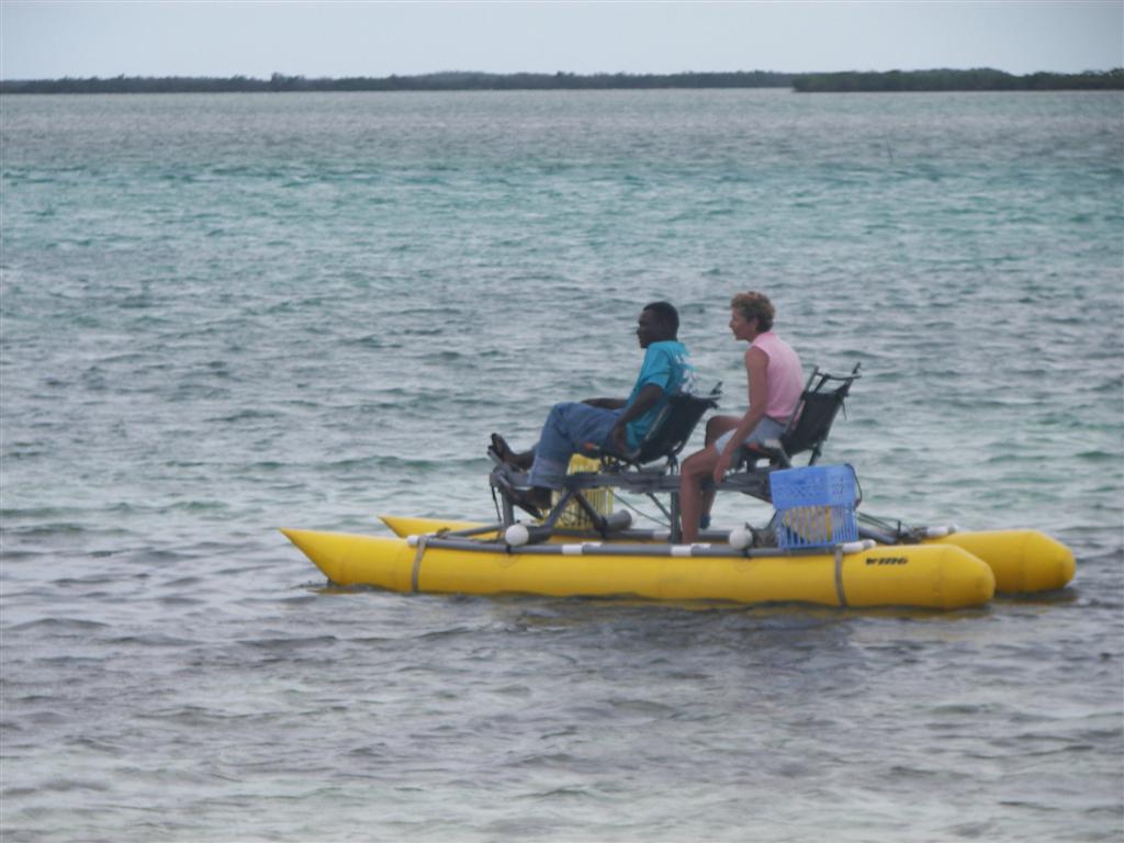
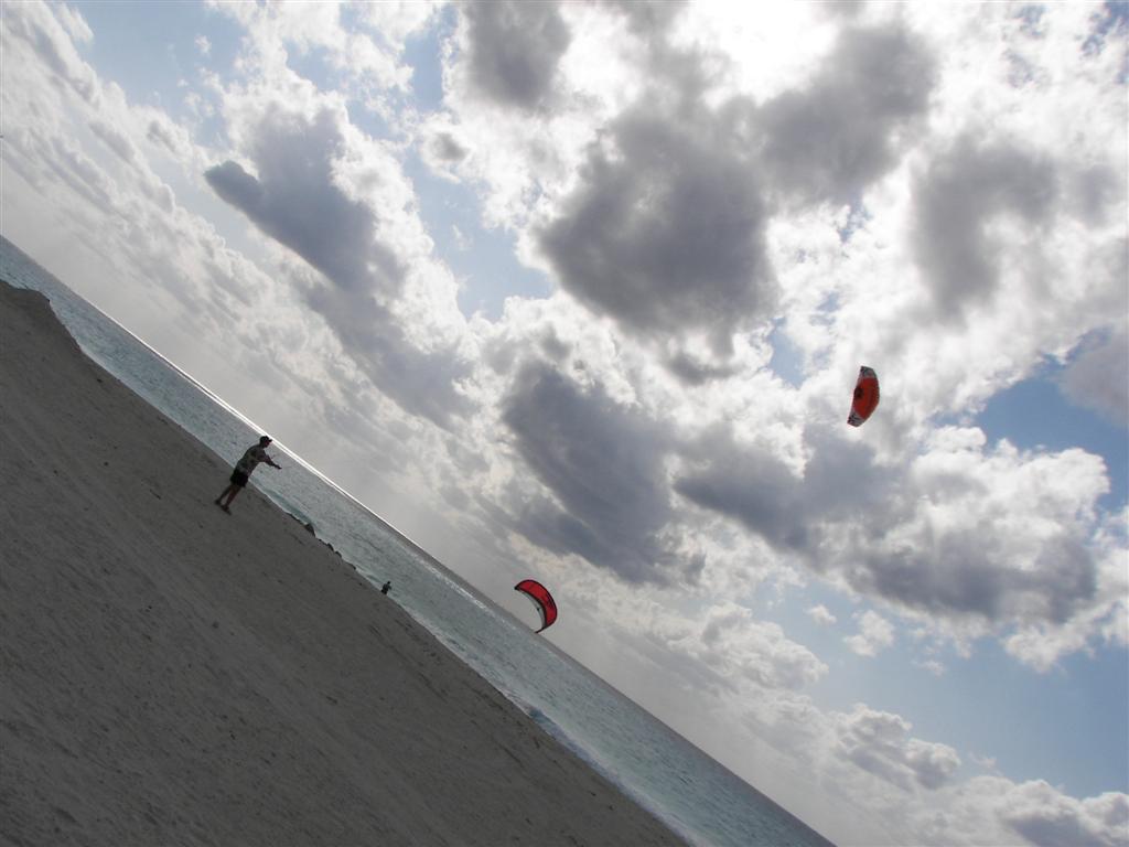
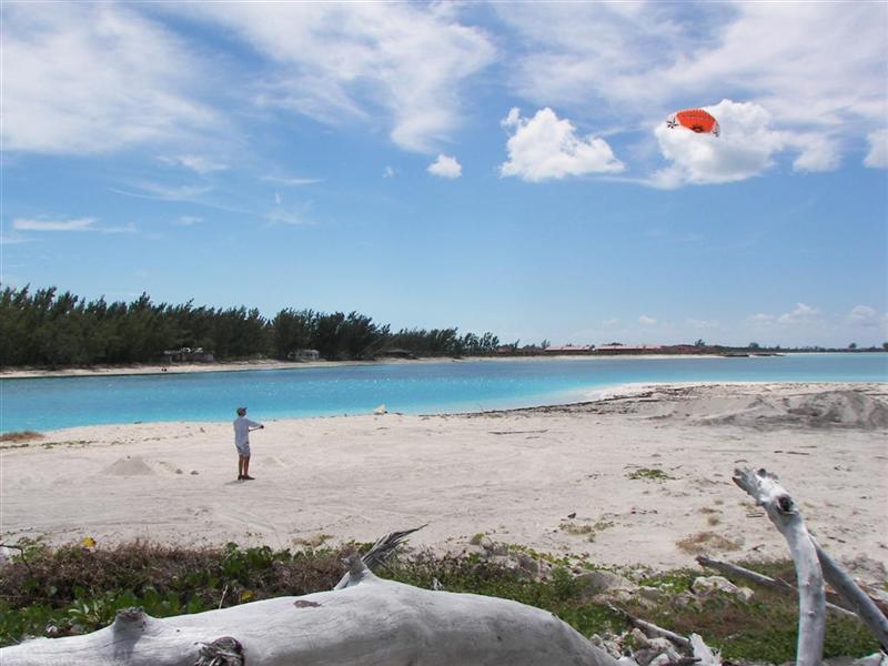
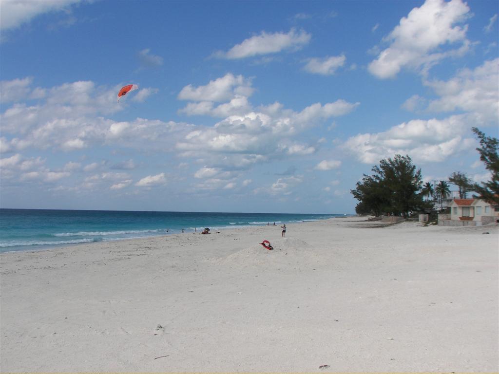
Other Activities.
I had lots of kite
flying experience with my kiteboard kite. Flew it in various winds from different beaches.
Also flew it from Pedigo a few times. Trying to work out a system to sail
Pedigo at least downwind with the thing. Karin
even got into it on the biggest beach.
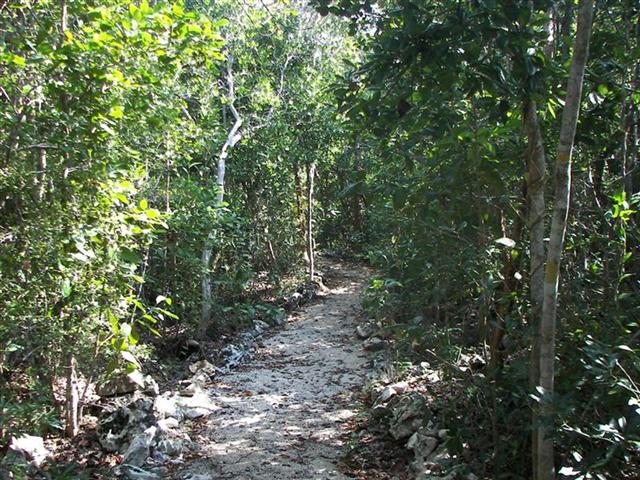
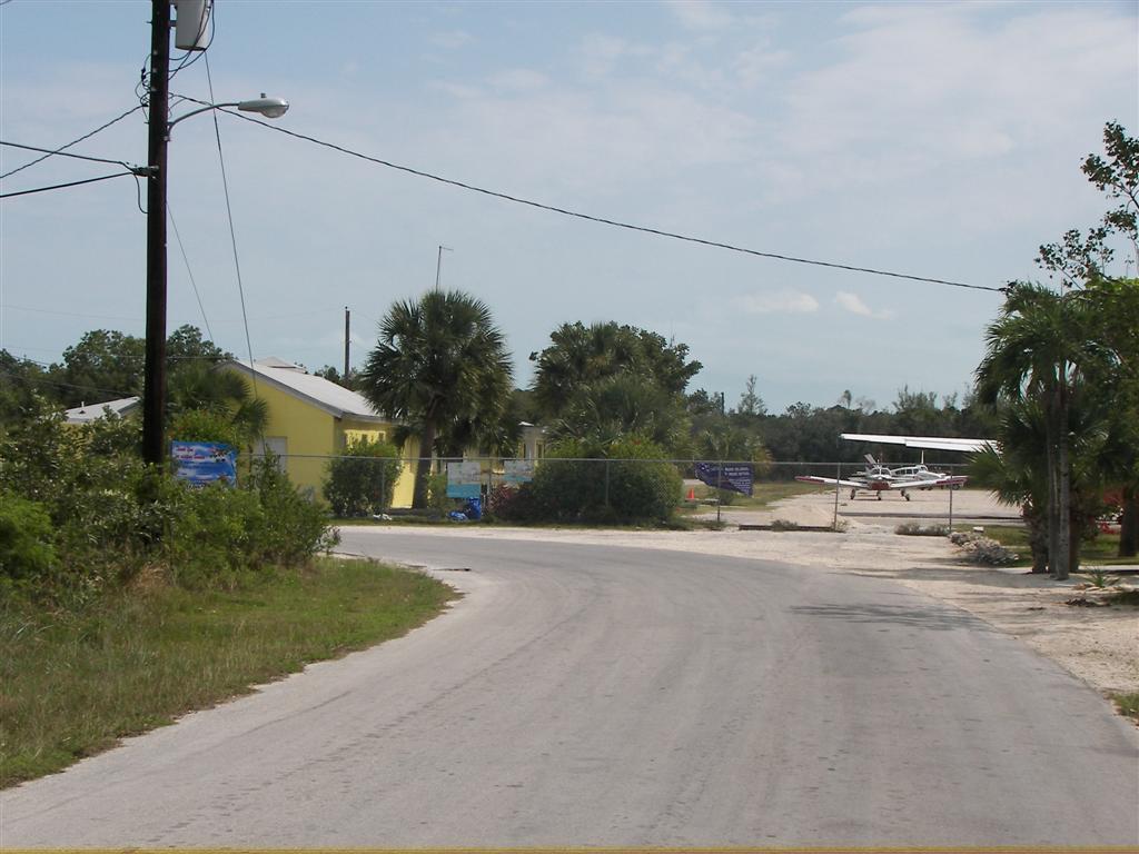
We hiked around East Bimini, a
mangrove-bound sister island to North Bimini; and cycled South Bimini,
an island to the south [duh] that has one marina, two resorts, and a few dozen
residences. This is
where the airport runway for the South Bimini INTERNATIONAL AIRPORT is.
(The North Bimini INTERNATIONAL AIRPORT only accepts seaplanes.)
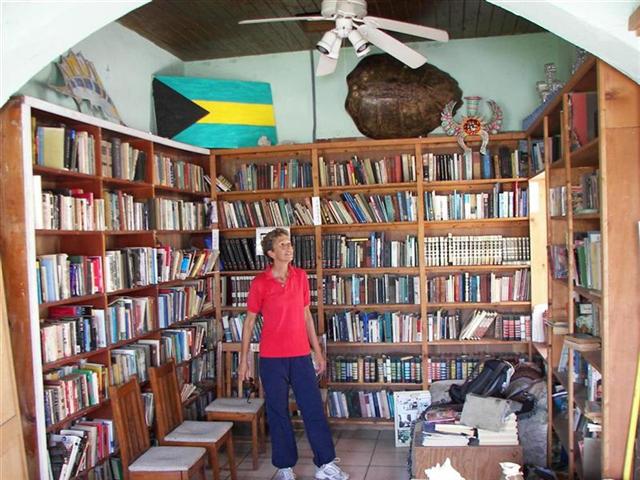
Karin also
reorganized the Bimini Memorial Public Library and Museum (and let me
rename it – ha). It was a sorely needed task!
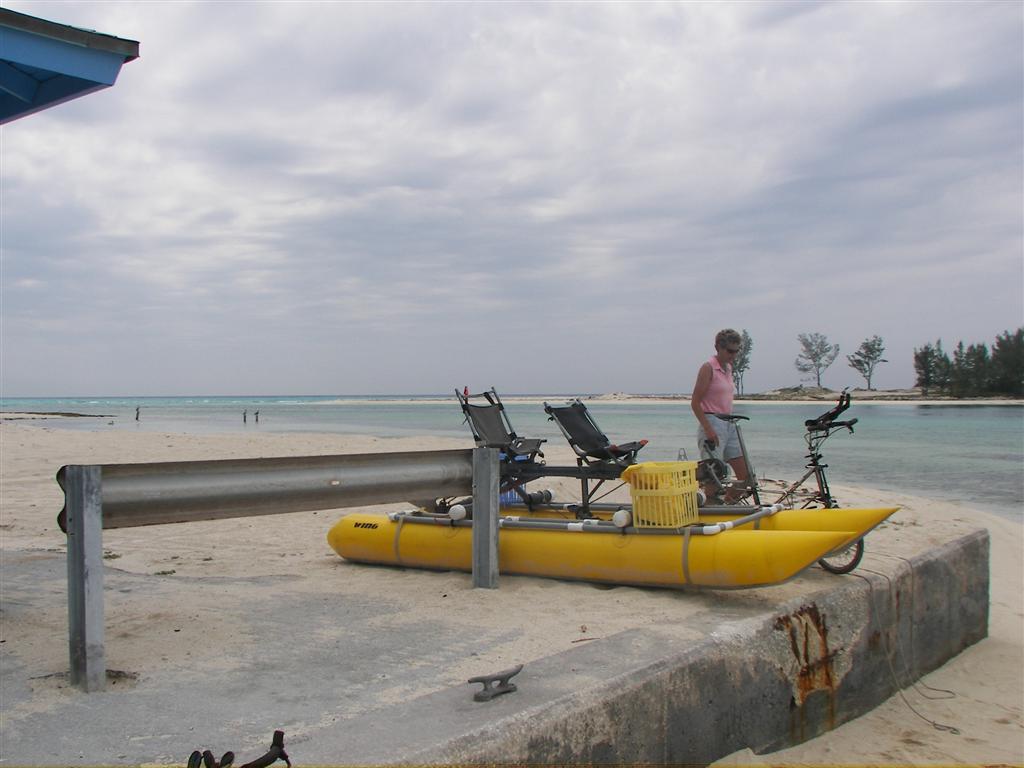
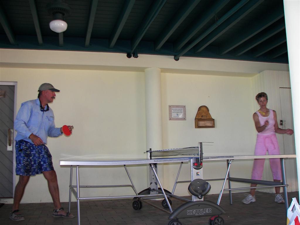
We stopped into the marinas occasionally
for a shower ad a game
of ping-pong [TABLE TENNIS for my friend Cliff].
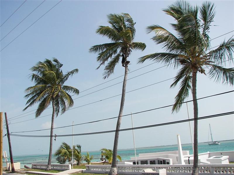
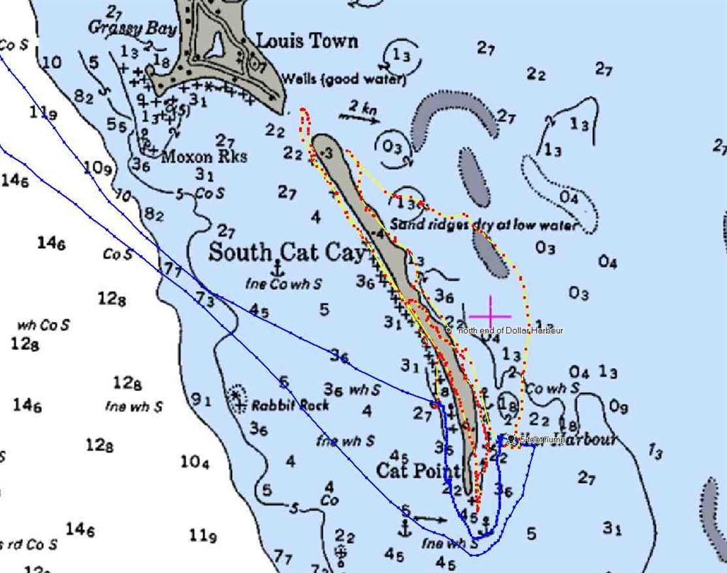
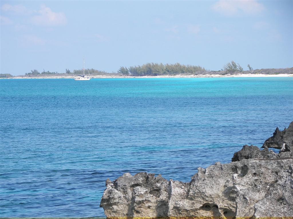
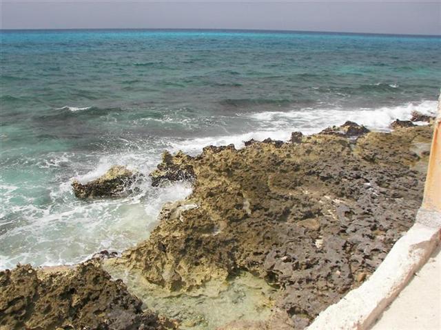
Island Geology.
I’ll use this last section to show the
pictures from Cat Cay, an island in
the Bimini chain 20 miles south of North Bimini. We anchored here for several days
waiting for the weather to be right for a Grand Bahamas Bank crossing.
The Bahamas banks (and islands) are made of aragonite, named after Viggo
Mortensen’s character in Lord of the Rings. Just kidding about the Viggo part.
This aragonite is calcium carbonate, heavier and harder than calcite, has less
cleavage, and occurs less frequently. It is basically the remains of dead
creatures, their shells to be exact, deposited over hundreds of millions of
years. So many epochs, in fact that many, many ice ages passed in that time;
when the world’s water supply is frozen up in an ice age, ocean levels can drop
hundreds of feet. So these deposited mounds of aragonite were formed, eroded by
water, eroded by wind, rained upon, submerged again, “inhabited” by billions of
more creatures which die when the ice age drops the water, over and over and
over again. The Bahamas are a big deal in world geology!
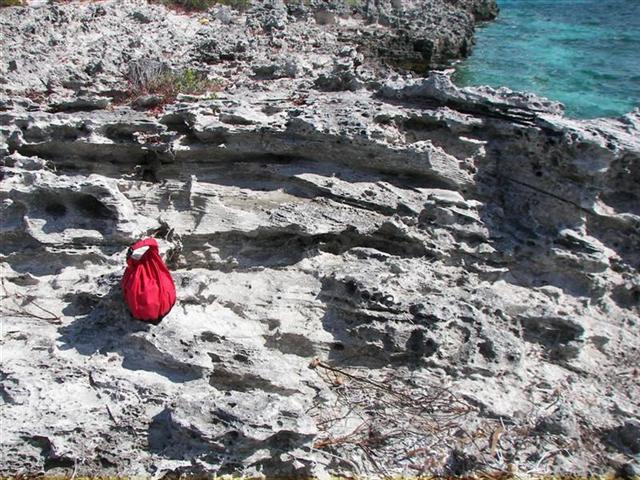
Some of the stratifications in the sedimentary rocks resemble the Wisconsin Dells area,
on a 1:100 scale! Trekking around Cat Cay was a challenge when the tough scrub
brush reached out to the sloping rock cliff; at times it was easier to walk on
the submerged rock shelf in the water.
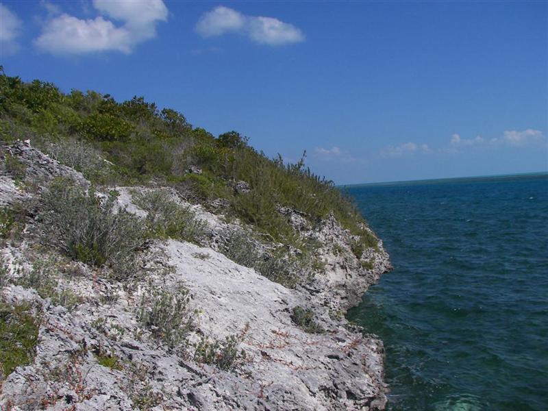
Along the way, coral reefs built up in
certain places alongside the aragonite, one of them becoming the reef along the
eastern side of Andros Island, the third longest barrier reef in the world.
Vegetation
caught hold on the exposed rocks and cycles of forestation produced soil in
places. Wildlife flew here or swam here or was brought by visitors. A slow,
painstaking process for sure!
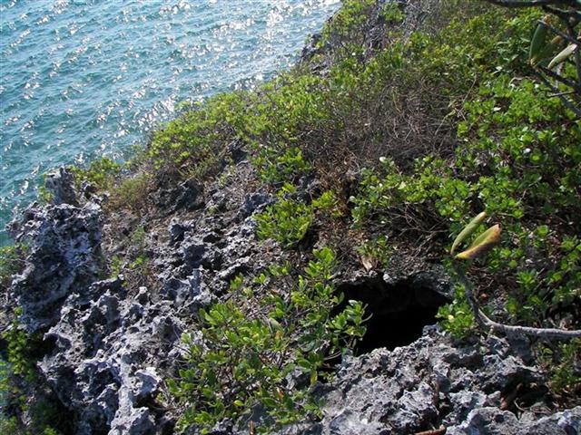
Blue holes are sought after features in all
the Bahamas, Caribbean and Central America. Divers marvel at their structural
beauty. These flooded very, very deep vertical caves have ocean connections and
if explored at the wrong tidal cycle, can trap a diver for the duration of the
tidal flow, usually six hours. Unfortunate if the diver has only single tank of
air! The formation of these structures is now understood to have been formed
during an ice age, when the ocean level was very low exposing much of the
island. Rain eroded the vertical shafts
down and down until it reached the height of the island and joined the ocean.
When the ice melted and ocean levels rose, these holes filled with seawater and
are now very deep pockets on dry land or in shallow water.
[This is similar to what has happened to
the wells in The Bahamas; earlier I mentioned that they were ruined by overuse.
The “wells” in the Bahamas were just very deep pockets in the islands, filled
with eons of rainwater, ‘floating’ on top of the seawater connection at the
bottom of the pocket. If the water was used at a reasonable rate, the pocket
acted as a cistern, and held rainwater for the next usage. Overusage of the
freshwater in the pocket caused the seawater to reach up close enough to the
top of the well to mix with the freshwater. Once mixed, there is no going back;
it is brackish forever.]
Because of the water-level controlled
creation, and constant erosion, the highest point in The Bahamas is just over
200 feet. There are NO RIVERS in The Bahamas; I find this to be most
fascinating, coming from a place where there is nowhere WITHOUT rivers.
The original Bahamians were known as the
Lucayan Indians, discovered by the early European Conquistadors, who captured
the able-bodied for enslavement on Hispanola, killing the rest. Wiped them out
more thoroughly than the Incas, Aztecs, or Mayans. Nothing remains to piece
together their society. I found in the
aragonite what appears to be a small footprint inside a larger footprint.
The toe prints are clearly visible. Is this a petrified track from the
Lucayans?
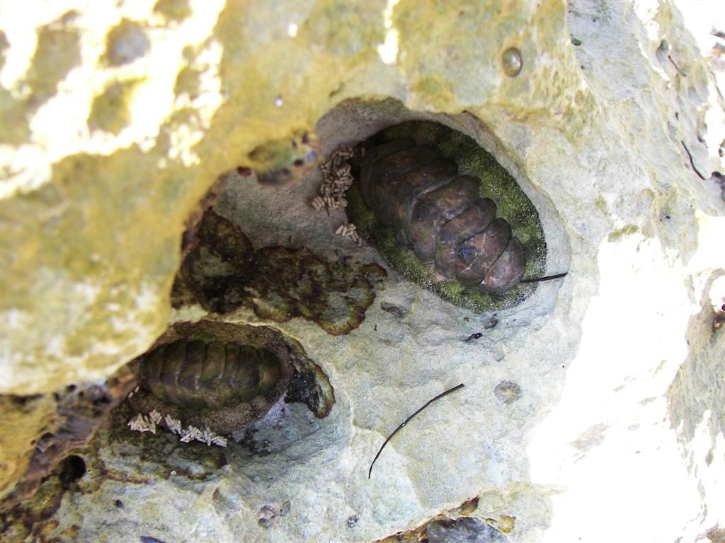
More interesting are the creatures I saw living in the crevasses in the
rocks along the shore of Cat Cay. For the life of me they look like the
trilobite fossils I collected on the shores of Lake Michigan as a kid. Can
anybody look this up for me? (I don’t have fast browsing internet long enough
or often enough to do this.) They are ‘cemented’ to the rock by a moss-like
fringe that appears to be the edge of their body. Lots of them had the little
piles of white elongated things that could be eggs? Larvae? Poop?
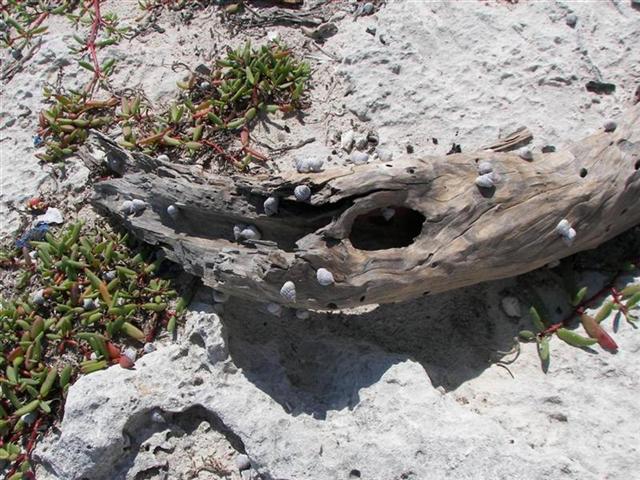
Sea snails: small, regular, and giant, are abundant everywhere on these uninhabited
islands. Island construction continues
. . .
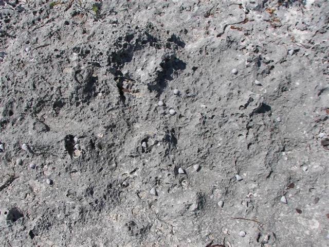
Hermit crabs are profuse on all the
Bahamian islands. Here, a rare mammal track
crosses several crab tracks in the sand. On Cat Cay, it seems many of the
larger hermits outgrew their shell, and got caught out in the sun
shopping for a new home. The birds feast on these unfortunates.
This ends the
tours of the Bimini Islands, and now a feature I intend to place at the end
of every eletter for our cruising friends:
Cruising Notes.
This new section is NOT a substitute for
cruising guides; I’ll just try to supplement their information with up-to-date
local knowledge and some tidbits a book publisher may hesitate to print.
Remember: this advice is
FREE, is well worth the price, and there’s a money-back guarantee.
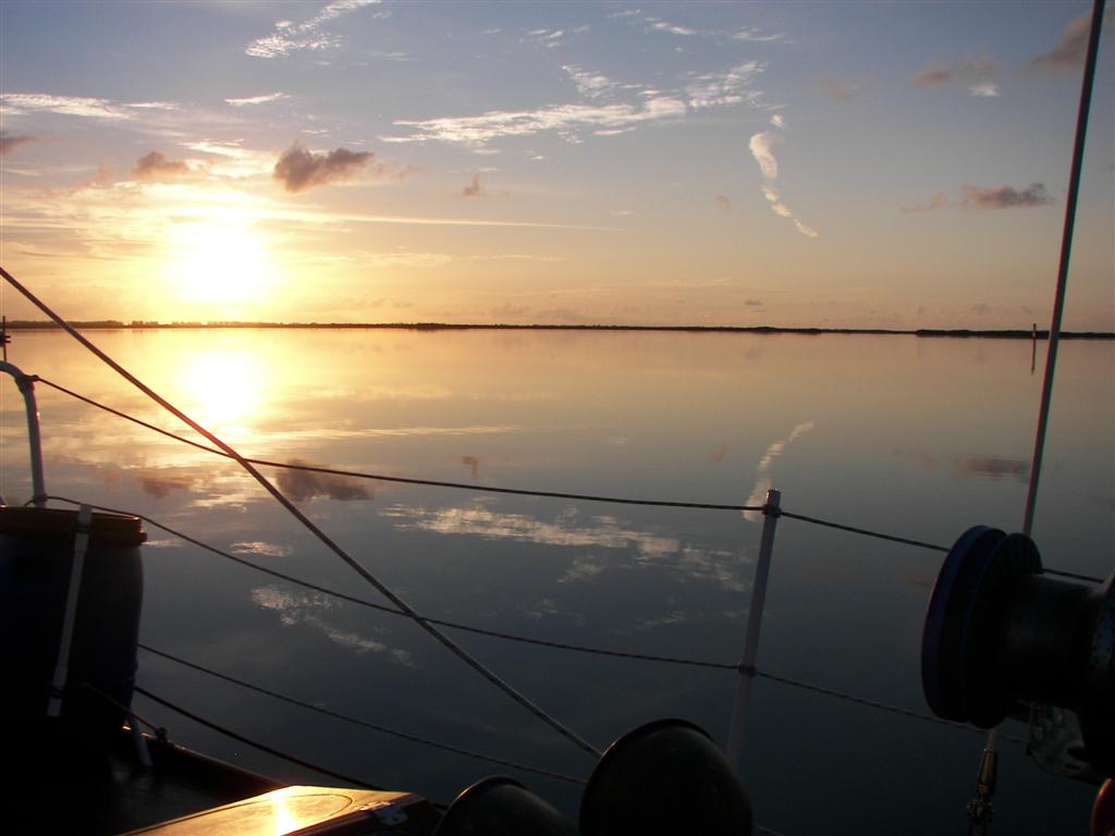
When sailing to Bimini, start out as far
south as you can.
We left from Carysfort Reef, and just
barely made it as the wind made an “unexpected” shift as we made landfall.
EXPECT THE SHIFT! It will happen.
To make the crossing enjoyable for all [are
you listening first timers?] do not be in a hurry; sailing south in the Hawk
Channel for a day or two is nice, gets you lined up, and can easily be done
during the night.
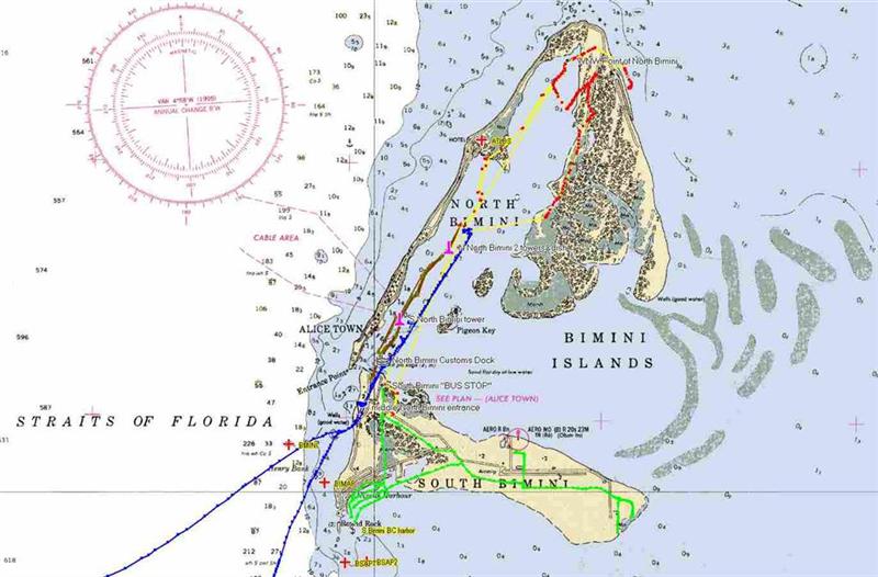
Ignore all the old blah, blah, blah about
staying right next to the shore of South Bimini for the entrance to North
Bimini; there is a newly marked channel. Just reach whatever first approach
waypoint you have- the one well south of the tip of North Bimini ‘cause there
is a nasty reef there, and then look for the buoys marking the entrance. To
make this entrance easier, DO NOT do it with a strong wind with ANY westerly
component. The breakers over the nasty reef get . . . nasty.
Once in the harbor, look for the yellow
& pink Customs building. It is at this Government
Dock. Docking here is free for check-in. The door to Customs is around the
west side of the building. It’s $300 for boats over 30-feet, $150 for those
under 30-feet. ASK for a fishing license here – it is included in the cost, but
I a separate form.
After you are done there, go to the little
building just north of the Customs door to Immigration. Be patient, this office
is not always manned; just hang out until the man comes around (don’t worry,
he’s just down the street at his girlfriend’s place). Get the forms that everyone
onboard must fill out.
That’s it – now you don’t need assistance
from a “hustler”!
A shoal-draft anchorage is immediately
north of the two [adjacent] marinas. A much better (for your boat) anchorage is
a mile north. This makes for a longer trip to “downtown”. Follow the daymarks
of the well-marked new channel north; at the last set of markers there is a
deep anchorage to the west near the shore. Leave enough room along the new
seawall to the north for this is where a small tanker visits to provide fuel for
the Bimini Bay project.
Also leave enough room by the dock on the
shore; a nice man named Carlos Martinez owns this developed empty lot and uses
it to dock his boat and have a play area for his kids. (His vacation house is
across the street.) While he wasn’t around for our visit, the caretaker of the
lot Charlene Brown, allowed us to not only leave our dinghy on the shore and
access the road there, she let us lock up our bikes on the lot.
Not that we asked initially, but we spoke
with her at the first opportunity. We find that getting kicked out is slightly
more probable if you ask, so we have developed the policy to care for all
lands, public and private; treat all peoples with respect; and never ask
permission. Occasionally we are told “no” later and then we move. Most of the
time we live our lives in a careful and respectful fashion and are allowed to
do what we do.
The east side of Cat Cay is called Dollar
Harbour. It extends quite a way from the shore at the southern tip of the
island, and gradually narrows in. It goes more than halfway up the island.
There is one hump that has 5˝ feet of water over it at low tide. It is very
small, and the seven-foot draft of Windigo found it. We floated off as the tide
rose.
When the wind kicks up from the east, the
open west side of Cat Cay is very comfortable. Stay well off the southern tip
[Seas follow it around and swells come north from there a ways]. Tuck in close
to shore halfway up the coast – you’ll see the dark water right off a sand
beach. This spot is only minutes from the Gun Cay pass that you’ll go through
to cross the Great Bahamas Bank, which you’ll hear about in the next eletter!
See where Windigo
has been:
http://shiptrak.org/
Enter Windigo's
callsign: W3IGO
Where we are right
now:
Our permanent and
EXACT address:
Capt.KL &
Karin Hughes
S/V WindigoIII •
PMB 365
88005 Overseas
Hwy. #9
Islamorada,
FL 36033-3087
Text-only Email
addresses aboard Windigo, checked daily:
[reliable
communication]
Email addresses
checked when at a land-based computer
(infrequently, but
good for attachments):
And of course, the
Windigo Travelogue Catalogue: